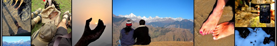

Room with a view
Day 2: September 29
We woke with the consciousness that we were into Day 2 of the trek. Though a bit chilly, we knew it was going to be a much warmer morning as compared to the ones we will wake up to in the next few days. There was yet another consolation in store – this was the last of the genuine (read non-pit) toilets for the week ahead – so there was quite a beeline for the toilets – both Indian and European for that matter – already. By 7.30, we were all ready, breakfasted and even through with Raj Bhaiyya’s morning drill.

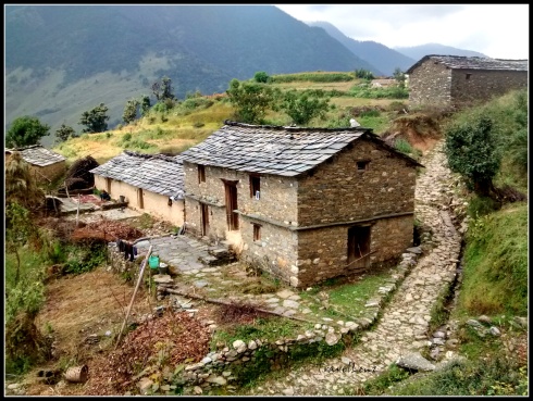
View from Didna
We set off at 7.45 am. There was a “slow trekkers” group formed on the basis of the performance that the guides made out on Day 1. They had already left about half an hour back and the rest of us also set out in trickles of small groups. We took our first unofficial stop in 10 minutes at a brook to top up our bottles. It was also the first time we were filling directly from a natural source – a sign that we were now high up and the water pure.
The climb, to begin with, was fairly steep and got our limbs working immediately. The ground was slushy, but navigable, and in no time our Quecha trekking shoes were smudged and dirty.

The entire walk is through a mixed forest covering the whole range of oaks, pines, deodars, and fir interspersed with broad leaved ferns and some brightly coloured mushrooms too. We must have ploughed on long enough to feel relieved at reaching a more level ground. As we walked out of the forest cover we spotted swirls of smoke – an evidence of inhabitation.

Walking into Tol Pani village
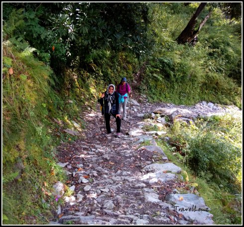
We had reached the small village of Tol Pani by 9 am, our first official stop for the morning. Though the trail was completely shaded we did feel thirsty after the steep climb. As we trudged through the village, we noticed the water source Raj Bhaiyya had mentioned during the morning drill. We were supposed to fill our bottles as this was the last water source before we reached our camp site, Ali Bugyal. The forest village comprised of a row of thatched houses interspersed with fields containing different crops. The forests provided not only fuel wood but also extensive grazing land for the livestock.

The beautiful forest village – Tol Pani
After Tol Pani, starts the almost vertical but zig-zag climb that passes through dense oak forests. We tried taking a few shortcuts, clambering across the tree roots, instead of walking along the well tread bridle path. But we realized that these shortcuts we took, shortened the journey, but the energy required was often greater than the time we saved.

We kept asking Raj Bhaaiya “How much more time?”, more due to our hunger than our tiredness. Whenever we asked our guides “How much further?” they would reply with, “Just half an hour more.” We would continue with renewed vigour and end up walking for more than 2 hours. Our incentive in the form of paranthas and boiled potatoes/eggs waited for us at Tol Top. There was just one agenda for us at the moment, to reach Tol Top and have our packed mid-meal.
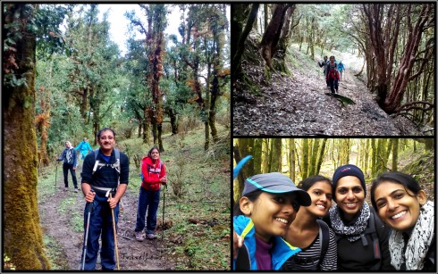
By 10 am the difficult part was over and we reached a more level ground. The sun was barely trickling through the trees which had grown tall and bent over to form an extended arch. There’s nothing more enchanting than walking through a tree lined pathway carpeted with a permanent cover of moss and dry leaves, with the light spilling through the branches. For a few minutes we even forgot that we were at a height of more than 3000 m.

An archway of trees
By 10.40 we emerged from the trees and walked onto a small ridge. We had reached Tol Top, the starting point of the famous Himalayan highland meadows. We flung our backpacks onto the grass and took in the views around. The faster trekkers had already munched onto their mid meals and were lazing around. From the ridge, the villages, houses, paths and fields appeared below. Everything looked so small from this height.

View of the villages and road from Tol Top
After all we had touched 3000 m. On a sunny day, you get clear views of Nanda Ghunti. Today was not our day; the mountains were hidden by a few low adamant clouds. Raj Bhaiyya pointed out a road in the distance – the road from Wan village which we would take back on our return journey.
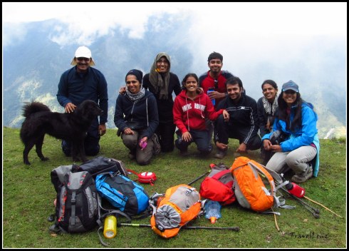
@ Tol Top with a furry friend [Courtesy Ani & Sabari]

Entering bugyal land [Courtesy Ani & Sabari]

The clouds were dark grey with hints of a noon shower. It was a wonderful feeling, sauntering over the bugyals, running down a lot, clambering up a few, with only the grey misty skyline around.

The Ali Bugyal meadow stretched out far and wide ahead, but the camping areas are limited to the fringes of the bugyal, where there are sources of water.

By 1.00 pm we could spot our campsite in a distance. The campsite was located just on the side of a small mountain which had a huge ‘Z’ mark on it.

It took us another 20 minutes to reach the camp site – our first tented accommodation of the trip. We had walked for 10.5 kms today, climbed 1000 m and were now at an altitude of 11520 ft/3510 m. Our Ali Bugyal camp had 11 tents, 1 bigger mess tent, three fibre glass tents and a couple of toilet tents.

Further down, we could see a clutch of tents where a few Americans had parked themselves. By the time we had booked our tents by marking our territory with our back packs, we were called into the mess tent for a glass of warm lemon juice.

A lot of us wanted to sleep off our tiredness, but Raj Bhaiyya was not in favour of an afternoon siesta. Light exercises and activities during the day are better than sleeping because respiration decreases during sleep, exacerbating any altitude sickness symptoms. So to make us work out a bit, he decided to have a campfire that night. We would already cross the tree line by tomorrow and it would not be possible to find log and wood from next day onwards. Carrying those oak branches and wooden logs from a nearby forest was the acclimatization task for that day. We spent the evening playing games and singing around the bon fire.

The mountain views were still obscured by the clouds and mist. Somewhere in the distance Nanda Ghunti, Trishul, Kali Dak, Chaukhamba, and Neelkanth, were staring back at us.

It did get cold in the night, however, we all had our thick woolies on and sleeping bags. It was the first time for a lot of us – sleeping in a sleeping bag in a tent. It was easier said than done. But after a struggle, we could finally squeeze into the tiny space and lay down, two in a tent plus our 60 L back packs and 30 L day packs. We looked like a bunch of modern Egyptian mummies. The night went sleepless inside the tent, without being able to toss and turn. But just to realize that we were sleeping on a Himalayan meadow @ 11500 ft – priceless.
Tomorrow we would move to a higher camp, where the mountains are nearer, stars are clearer, air is thinner and the earth is colder. Tomorrow we move onto Day 3.
Day 2 in a nutshell
- Day 2: Didna village to Ali Bugyal
- Distance: Around 10.5 kms
- Altitude: 8530 ft to 11520 ft [2600 m to 3510 m]
- Terrain: Uphill trek from Didna via Tol Pani to Tol Top for the first three hours. Easy trek from Tol Top to Ali Bugyal for the last two hours.
- Difficulty: Easy to moderate
- Time taken: Around 6 hours including a mid-meal break


![[Courtesy Ani & Sabari]](https://travellenz.files.wordpress.com/2016/03/img_5008.jpg?w=490)
![Countryside [Courtesy Ani & Sabari]](https://travellenz.files.wordpress.com/2016/03/img_5011.jpg?w=490)
![Stone bridge on the way [Courtesy Ani & Sabari]](https://travellenz.files.wordpress.com/2016/03/img_5018.jpg?w=490&h=435)
![[Courtsey Ani & Sabari]](https://travellenz.files.wordpress.com/2016/03/img_5039.jpg?w=490)
![Crossing Bedni Ganga [Courtesy Ani & Sabari]](https://travellenz.files.wordpress.com/2016/03/img_5056.jpg?w=490&h=370)

![Team at Didna [Courtesy Ani & Sabari]](https://travellenz.files.wordpress.com/2016/03/img_5086.jpg?w=490&h=325)


