Tag Archives: Uttarkhand

Roopkund Chronicles – Day 6 Pathar Nachauni to Loharjung

Day 6: October 3

On May 12, 2005, high-altitude mountaineer Ed Viesturs reached the summit of Annapurna, the deadliest mountain in the world in terms of summit-to-kill ratio. In doing so, he became the first American and the sixth person ever to climb all 14 of the 8,000 m peaks without the use of supplemental oxygen.

Ed Viesturs [Photo Courtesy Pinterest, National Geographic]

Ed Viesturs [Photo Courtesy Pinterest, National Geographic]

He is famous for his conservative approach to climbing – he once turned around from a mere 300 feet from the summit of Mt. Everest!! He is also famous for a popular and inspirational mountain quote, “Getting to the top is optional, getting down is mandatory. A lot of people forget about that. “. He wrote this in his memoir – No Shortcuts to the Top.

This should be the philosophy that underlies all mountain treks. After all, it’s only if you get down safely that you get to go back another time.

Pathar Nachauni camp

Pathar Nachauni camp

We were to begin our long ‘mandatory’ journey back from Pathar Nachauni to the base camp, Loharjung, today.  For going up the 22 km from Loharjung to Pathar Nauchani we took around 17 hours, spread across four days. The return journey was to be completed in a single day. We were to walk for 16 km and we were bypassing Ali Bugyal and Didna village and taking a different route via Bedni Bugyal, Patal Ghaeroli and Wan. We would descend from 12700 ft to 8028 ft (3908 m to 2447 m) in a single day. Incidentally, our return route was also the alternate route from Wan village to Bedni Bugyal.

This was our last day on campground. These tents had been our homes for the past few days. Even though I had some trepidation about staying in a “tent”, I was wonderfully proven wrong.

Our march from Pathar Nachauni begins

Our march from Pathar Nachauni begins

We started from Pathar Nachauni at 08.30 am. The first couple of hours were easy. We were retracing the same steps we had taken a few days back. We passed through Ghoda Lautani and passed onto the other side of the mountain.

The journey back – somewhere between Pathar Nachauni and Ghoda Launtani

With the promise of a much easier day on the trail with plenty of downhill stretches as opposed to uphill slogs, we thought we’d just sing and walk – we were proved wrong in a couple of hours.

On our way we met a lot of people headed up to Roopkund. There were frequent exchanges of “congratulations” and “all the best” amongst us.  At around 10 am, we got our first glimpse of Bedni Kund.

First glimpse of Bedni Kund

We had to climb down a moderately steep path to reach Bedni valley. We remembered we had seen a few trekkers from another group climb that route on our way to Roopkund. And we thanked ourselves that we did not have to climb that way. Climbing down was not that difficult. We had stepped on to the green carpeted Bugyal lands and were leaving the snow behind us. We passed the colourful camps we had seen on our way up and reached the Kund. Near the Kund were a couple of stone temples.

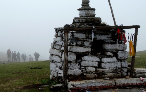
Stone temple at Bedni

Stone temple at Bedni

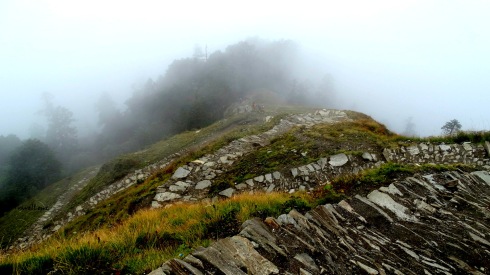
By 10.45 am, we had left the grass lands of Bedni behind. From thereon, begins the steep descent to Neel Ganga. The path was paved with cut stone.

The descent from Bedni begins here

The descent from Bedni begins here

Raj Bhaaiyya asked us to lengthen our poles. Climbing down was harder than we thought as we had to concentrate more, and had to keep a constant vigil on where we placed our foot. Descending constantly is not easy; it takes every ounce of energy and breaks your knees down. I was already feeling a bit sore beneath my toes.


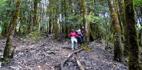
The forest was dark and once in a while the sunlight took a peak through the canopy. But walking within the silent woods gives one an enchanting feeling…. the dry leaves crumbling beneath your feet to indicate your beautiful journey across the forest trail.

Oak forests of  Ghaeroli Patal

By 11.20 am we reached the forest camp in Ghaeroli Patal and had our mid-meal. After a quick rest, we were moving again by 11.45 am.

FRH at Patal Ghaeroli

FRH at Ghaeroli Patal

It was a shortcut time for a few – they abandoned the stone trail and went on a sliding spree across the mud and roots.

And I guess the ‘short cutters’ gained a lot of distance as we could see them far away down in the valley.

Spot the trekkers

Spot the trekkers!

There were small openings in the forest, and as you climb down, you get a peek of the villages through these openings. By 12.45 we got our first glimpse of Wan village…though it looked quite far off.

By this time we could listen to the rushing waters of the Neel Ganga River. We reached the river by 1 pm and spent around 20 minutes resting and dipping our sore toes in the cold water.

At Neel Ganga

At Neel Ganga

From the Neel Ganga River, it took another 30 minutes to climb to a ridge above Wan village. From there began the long journey across Wan village to a place where a vehicle would be carrying us back to the Loharjung base camp, 15 km away.

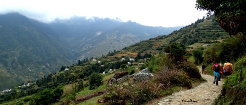
Walking into Wan Village

Walking into Wan Village

The village of Wan, with its numerous chickens, fluffy dogs and beautiful children with cheeks worthy of biting into, looked like any other Uttaranchali village.

We found villagers going about their tasks; it was evening, so most of the women and men were returning home after their chores. Children hovered around greeting us with Namasthes and then asking for chocolates and pens. One smarty guy wanted my water bottle!

Kids at Wan vollage

Kids at Wan village

As we neared the road head, we met a couple of ladies. One of our team members struck a conversation with them and one turned out to be the ‘Pradhaan’ (chief) of 8 villages, Usha Devi. She offered us fresh produce, juicy cucumbers from her field and tea. A head strong lady, she talked a lot about her life in the village and how she had worked towards getting a road built to the village, stopped people cutting trees on the mountainside, travelled to Lucknow to get her voice heard and to Delhi to give a speech on environmental issues.

Smt Usha Devi (left)

Smt Usha Devi (on the left)

By 3.30 pm, we’d reached the road head and our jeeps were waiting for us. We reached our camp in Loharjung by 4 pm.

When I finally limped up the staircase of Patwal Lodge and flung my backpack onto a corner of the dormitory, the realization that I had actually completed the Roopkund trek dawned upon me. At once, I felt fully drained, yet totally alive.

There was a special dinner ordered for us and we were given our certificates of completion, besides being asked to speak about our experiences.

The next day our jeeps came early and we began our long journey back to Kathgodam and then Delhi and back to our respective homes.

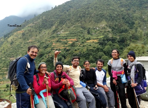
The full team at Roopkund [Courtesy Shivam Singh]

The full team at Roopkund [Courtesy Shivam Singh]

For the next few days, I was wincing whenever I had to climb up or down a step, a deep tan had taken over my face and my hands, my lips were chapped, and I had blisters on all my toes. I had walked 53 km in 6 days over mud, rocks, ice, grass, snow and horse dung, at low oxygen levels, with bare minimum amenities, without taking a bath and yet when I closed my eyes, I felt a calmness and serenity within. At night (and sometimes during the day!), I often hallucinated that I was marooned in a deep sea of white clouds, looking out at endless vistas of mountains stretching as far as my eye could see.

Our guides (clockwise from L to R) Amar, Pushkar and Raj

Our guides (clockwise from L to R) Amar, Raj, and Pushkar

This journey would never have been completed without the help of the friendly support staff from TTH – be it our guides, kitchen staff, porters and even the mules. Last but not the least these adventures wouldn’t have been as fun as it had been without the awesome company we had!

Uma, Ammu, Nithin, Ani, Sabari, Sree  and us – let’s climb another mountain!!


Day 6 in a nutshell

  • Day 6: Pathar Nachauni to Loharjung
  • Distance:  16 km
  • Altitude: 12700 ft to 7575 ft
  • Terrain: Gradual descent from Pathar Nachauni till Bedni Bugyal. Steep to moderate descent from Bedni to Neel Ganga. From Neel Ganga to Wan gradual descent.
  • Difficulty: Easy to moderate
  • Time Taken: Around 7 hours


Roopkund Chronicles – Day 4: Pathar Nachauni to Bhagwabasa

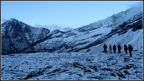
Morning at Pathar Nachauni

Mountain view from Pathar Nachauni

Day 4: October 1

Having slept like a log through the night, I woke to the unmistakable sound of light rain falling on the walls of the tent. Not exactly music to the ears knowing that the morning’s hike upwards was now going to be done in the wet and slush.

Morning rain at Pathar Nachauni camp

We instantly knew it was going to be a cold day. The rain had stopped by the time we stepped out of our tents but the remnants of the wet weather clung onto our tent tops and sides, adamantly. When you’re in the mountains, morning chores become a stunted version of the more luxurious ones you are used to at sea level. First, it takes immense courage to brush your teeth and wash your face in the icy cold water: alternative – center-fresh and wet-wipes.

Clouds everywhere @ Pathar Nachauni

The rain from last night had turned to snow and the hills around seemed to look even more impressive covered in a fluffy white covering. The frost on the meadows was twinkling like crystals clinging onto the ground. The valley was shrouded with a cloudy mist, rising up in swirls – the effect was positively ethereal.

We had a tough trek ahead and the air was getting thinner. So Raj Bhaiyya decided we should have a warm up session before breakfast. The fun exercise did take away a little of the chill we had around us.

Climbing up from Pathar Nachauni camp

We started our trek at  8.30 am. Trekking up from Pathar Nachauni till Kalu Vinayak would be on a very steep trail. And we would be climbing up from 12,770 feet to 14,550 feet in the next 2 km.

Huffing and puffing up

The initial climb was gradual. We were mostly clambering over small hills and taking short cuts over grass land. And then the actual climb began – steep and slow. For the first time, nobody was waiting for nobody. No one spoke and we were just walking in single file, following each others’ footsteps. All of us were engrossed in our own struggles – some were struggling with their legs, some with their breaths and a lot with their minds.

The mist had not lifted and during some stretches we could barely see the person in front of us. We kept resting after taking 10 steps, but Raj Bhaiyya kept pushing us from behind with his reassuring words “take deep breaths through your nose, drink water”. A few had already complained of headaches and nausea the previous night, however, none of us had any serious health issue till date.

The mist on the way to Kalu Vinayak

As we huffed and puffed our way towards the top, our band of ever-amazing porters and ever-jingling mules began to pass us along the trail with relative ease, pushing our luggage onto our next camp.

A sole trekker enroute to Kalu Vinayak

Even in this cold weather, we were drenched in sweat but the air was cool.  Whenever we stopped for a break, we would get a chill from the cold sweat so we just kept on chugging along. We had been cut-off from the rest of the world long back, however, it was during this stretch, for the first time, that I had that feeling of solitude among the mighty Himalayas.

Unending trails from Pathar Nachauni to Kalu Vinayak

Through the thin air we could listen to a distant sound of ringing bells. Was it the sound of the jingling bells from our mules? To our relief, it wasn’t. Kalu Vinayak was only a few steps ahead and it was the simultaneous ringing of scores of bells by our enthusiastic ‘fast trekkers’ who had reached way ahead of us.

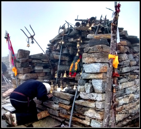
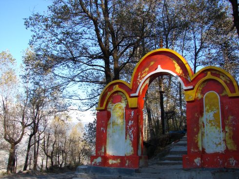
By 10 am the difficult part was over and we had caught up with them. We had reached Kalu Vinayak temple. Kalu Vinayak temple has a a black Ganesh idol enclosed in a stone shrine. As in most of the Uttaranchali temples found in the Garwal and Kumaoni regions, a lot of bells are hung around the temple.

Kalu Vinayak Temple

The feeling of relief on reaching the top was immense. As we waited for the rest of our group to complete the killer final climb, we had the opportunity to sit down and take a well-deserved breather. From Kalu Vinayak, on a clear day, the trail to Roopkund is visible. And a clear view of the the mountain ranges – Nanda Ghunti, Kali Dak, Trishul, Chanyakot and Chaukhamba. The clouds obstructed our 180 degree view of the Himalayas, but it was still one of the most beautiful feelings.

Trekker jam at Kalu Vinayak

From Kalu Vinayak the trek to Bhagwabasa was a cake walk because of the gradual descent. The path was paved with rocks, cut into small slabs and there was occasional snow along the path.

Rock trail to Bhagwabasa

Our destination Bhagwabasa was less than 2 kms away from Kalu Vinayak. On the way there was a cluster of stone huts and we later learnt that, earlier, those huts were rented out to trekkers for the night. However, now most of them were in a dilapidated condition and abandoned.

Abandoned stone huts on the way to Bhagwabasa

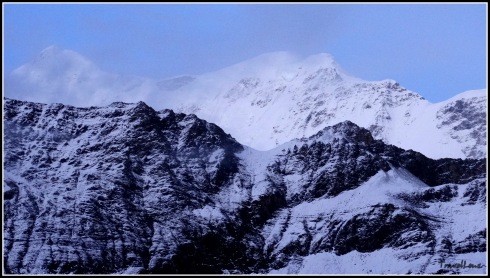
By 12 pm we walked into Bhagwabasa (14350 ft). The background was amazing – Bhagwabasa is set in a valley against a row of snow capped mountains. The sky was a deep blue and the white peaks were reaching towards the billowing clouds.

Rustic beauty of Bhagwabasa

The earth is in her glory here – you get to see some of the most magnificent peaks – Trishul, Nanda Ghunti, Chaukhamba – and we suddenly felt so insignificant.  These mountains have lasted here for an eternity. They are the lords of the land and we were merely visitors.

Trishul rises @ Bhagwabasa

Trishul rises @ Bhagwabasa

The camping ground had several rocks that lay scattered all around. The whole area was uneven. There were around 20 tents, a couple of larger tents and a few fibre glass structures. Our tents were not ready as a few trekkers were yet to reach from Roopkund, and their luggage lay in the tents. By the time we had our lunch, the Roopkund-bound trekkers had returned and had vacated the tents.

Bhagwabasa camp

Bhagwabasa camp

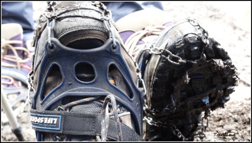
By 2 pm the weather changed and it started to drizzle with small flakes of snow floating about. But not for long. Later, we were called into the mess tent and were given crampons – a plastic addon, with metallic spikes at the bottom, that would be providing us the much-needed grip while we trekked on the snow the next day. The trek leaders showed us how to attach the crampons onto our shoes.

Crampons

Around 4.30, the clouds gathered again and snow began to fall, now with more force. The air was fresh and chill. Though, we were a bit worried about how this snow storm would affect the next day’s trek, we could not think of anything else except the present.

We had a little time pre-dinner to walk around the camp. The high clouds had already covered the tall peaks behind the Roopkund crater.

Bhagwabasa

Bhagwabasa after the snow fall

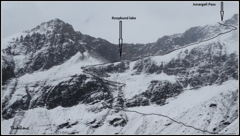
Raj bhaiyya pointed out the trail going all the way up from Bhagwabasa to Roopkund Lake and further on to Junargali Pass. The trail was clear. We could even spot a zig-zag path that looked really scary from here. We were to cover this 3 km trail, early in the morning before the snow melted.

The path from Bhagwabasa to Roopkund and Junargali

The path from Bhagwabasa to Roopkund and Junargali

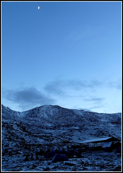
The setting sun was shining feebly across the frigid snowy landscapes far below and the expansive snow-capped mountains high above. The moon was slowly moving up now giving an almost blue-tinged tone to the snow.

Moonrise @ Bhagwabasa

Moonrise @ Bhagwabasa

The infectious support staff, with their friendly banter, helped to alleviate some of the aches and pains that were creeping into our limbs after a tough day’s climb.  Another great meal capped off a fantastic day on the trail en route to Roopkund.

Roopkund Lake lay only 3 km away from the camp. I still had to pinch myself knowing that I was just a night away from my dream encounter with the skeletons!!!! Tomorrow is summit day.

Day 4 in a nutshell

  • Day 4: Pathar Nachauni to Bhagwabasa via Kalu Vinayak
  • Distance: Around 5 kms
  • Altitude: 12700 ft to 14350 ft
  • Terrain: Steep ascent from Pathar Nachauni to Kalu Vinayak and downhill trek from Kalu Vinayak till Bhagwabasa.
  • Difficulty: Moderate to difficult
  • Time taken: Around 3.5 hours


Roopkund Chronicles – Prologue

Amidst the blinding white lay a clump of bones, propped up more inelegantly than it ever had been inside of a human frame, ages ago. Just how it came to pass that it still lay there in fresh snow in front of a troop of panting but relieved trekkers who braved the cold, the distance, the altitude and the reputation of a mysterious lake to stand and stare at it, is the stuff that great adventure trips are made of.

And that is what Roopkund is all about. Months of preparation and expectation, the bone chilling weather, the difficult mountain, the 4800 m (16000 ft) summit, the 53 km trek over 6 days, the wonderful company (of course!) and something that no other trek can promise – the unsolved mystery of untold deaths and the hundreds of human skeletons that adorn the rims and bottom of a hidden lake in the high Himalayas.

Over the next few posts I’ll be sharing our Roopkund Chronicles. Stay tuned for our moments of exultation, our lapses of consciousness, blissful mindfulness, fights with breathlessness, and being one with the precious stillness. The trek to the mystery lake begins here…..

For day wise stories click on the links below

Day 0: Kathgodam to Loharjung

Day 1: Loharjung to Didna

Day 2: Didna to Ali Bugyal

Day 3: Ali Bugyal to Pathar Nachauni

Day 4: Pathar Nachauni to Bhagwabasa

Day 5: Bhagwabasa to Roopkund to Pathar Nachauni

Day 6: Pathar Nachauni to Loharjung


Panchachuli – Close, Closer, Closest

I will never forget the first time I saw the Himalayan range. It was my first visit to Nainital and we were staying at the Swiss Hotel, which sits a fair way beyond the high court on the upper Mallital side. We knew there was a Snow view point that could be reached by a cable car, but we wanted to avoid the crowd. Then somebody at the hotel told us about a more secluded, off beat view point. We got the directions and started off by following a path right behind the hotel which took us to a flight of stone steps. We climbed the steps which led to a road. We started walking or rather climbing the road. When we passed some tourists coming down the road, we knew that we were on the right path. There were villagers carrying wood and calling out to each other rushing pass by us, small kids on their way to school taking short cuts. It was a bright sunny day, but the road was  shady due to the thick canopy. We must have walked for about 20 minutes when we came to a sharp turn. And there in front of us lay the Himalayan range, gleaming in the sun. The mountains gave a clear white picture against the clean blue sky. There were a handful of tourists, mostly foreigners enjoying the view from a watch tower and basking in the sun. A couple of small shops selling tea, water and biscuits were also around.

The Himalayan range as seen from Nainital

The Himalayan range as seen from Nainital

We had with us a postcard carrying all the names and altitudes of the mountains, visible from Nainital, for our reference. From the left there was Nanda ghunti, Trishul, Mrigthuni, Maiktoli, Nandadevi and its peaks, Pindari glacier, Nanda Kot, Panchachuli and then the peaks of Mt Api in West Nepal. But what stood out, for more than one reason, was the Panchachuli range. The name, the myth, and the simple reason, for the way it looked.

The Panchachuli peaks are a group of five snow-capped Himalayan peaks lying at the end of the eastern Kumaon region. The peaks have altitudes ranging from 6334 m (20,781 ft) to 6904 m (22,651 ft). The name is derived from the legendary Pandavas’ “Five Chulis” (cooking hearths), where they cooked their last meal before proceeding toward their heavenly abode.

When I saw the Panchachuli peaks lying there at the end of the graph, five peaks, one after the other, I had this sudden urge of seeing the peaks a little closer.

In the following years we made several trips to the hills. Binsar, Mukteshwar, Kausani being some of the destinations. The mountains never changed nor did the sheer excitement of seeing them. But that clear picture of the five peaks eluded me.

Once while visiting a photo exhibition, I came across a photo of the Panchachuli peaks taken from Chaukori. There were these pretty green cottages arranged in a neat row in a beautiful garden with the mighty Panchachuli peaks in the background. If the photo itself was breathtaking then I could imagine how the real place would be.  While admiring that photograph I was already making  plans to visit Chaukori. Chaukori, at a height of 6,595 ft, is a beautiful tourist spot with great views of the snow-capped Himalayan range.  The entire area has a lot of  tea gardens and fruit orchards that are simply great for treks.

Catching the sun on the way to Almora

Catching the sun on the way to Almora

So on a cool November evening we boarded the Ranikhet express from the old Delhi station to Kathgodam.  We reached Kathgodam by 6.30.  Before 7 we had already caught a shared taxi to Almora. The sun was already peeping through the pine trees and we slowly started climbing our way to Almora. We passed Bhimtal and Bhowali, and then stopped near Kainchi ashram around 8 to have breakfast.

Kainichi ashram

Kainchi ashram

By 9.30 we reached Almora.  Mist was hanging prettily over this hilly town. We had to walk  through a maze of small bylanes and markets to reach the taxi stand. From there we took a shared jeep to Berinag.  The jeep was over crowded and cramped. And the driver was still looking out for prospective passengers. At each bump the entire jeep groaned and shrieked. And to add to the agony the agarbatti fumes were making me sick. Though the journey was uncomfortable,  the scenery was beautiful and at its best. The mountains were playing hide and seek all the way.

On the way to Chaukori

On the way to Chaukori

The jeep stopped for lunch, that we conveniently skipped, at Dhaulchini.   By 2.30 we reached Berinag. Chaukori was just a half an hour drive from there. We reached the KMVN guest house by 3.30.

KMVN's cottages

KMVN’s cottages

And there right out of my picture postcard stood my favourite peaks. The trees from the picture had grown and were obstructing the peaks a bit.  A watch tower was conveniently placed on the grounds of the KMVN guest house. We climbed the watch tower and took in the scenery.

and the peaks

and the peaks

The sun was already going down and  the Panchachuli peaks looked pretty in the evening light. Tired and hungry from the jeep journey, we had dinner and slept early. We decided to get up early and explore the premises.

Panchachuli - before sunrise

Panchachuli – before sunrise

We got up before sunrise. Chaukori was slowly waking up to a lazy early winter morning.  We took a small path behind the guest house and walked through a tea garden till we reached an open space that dropped down to a terraced valley. From here the Panchachuli peaks definitely looked more spectacular than I had imagined.

Sunrise

Sunrise

The sun had started to peep over the Himalayan range on the Nepal side on the eastern side. Our camera was doing over time and clicking away.  The sunlight had started  to fall on the mountains and they  looked refreshingly new with every passing minute.  The mountains were definitely closer, but I wanted more. We decided to go to Munisiyari for the  closest view.

View from the watch tower

View from the watch tower

The journey from Chaukori to Munisiyari took almost 5 hours. We changed vehicles three times.  From Chaukori we took an overcrowded bus to Udiyari bend. From Udiyari bend we took a jeep to Thal. Here most of the journey was downhill. From Thal we crossed a bridge over Ramganga East, walked by a stone Kali temple  and came to a bazaar and from there we caught another jeep to Munisiyari. We were starting to climb the hilly road now.

Following the Kali river

Following the Ramganga river

The drive took us past some of the most beautiful valleys and the Ramganga river was accompanying  us all the way. Every bend brought a fresh view, often better than the last one. It was amazing how the slightest change in elevation altered the perspective completely.

Munisiyari, situated on the banks of Goriganga river, is a favourite destination for  high altitude trekkers and nature lovers  and is commonly used  as a base camp.  By 1 we reached Munisiyari.

KMVN Munisiyari

KMVN Munisiyari

The guest house was a  building with green roofs right out of the Raj era. And to add to the beauty of the guest house was the magnificent sight of the Panchachuli peaks.

Panchachuli from our room

Panchachuli from our room

We checked in, and our room had excellent views of the 5 peaks.  After lunch we decided to see the local Nanda Devi temple which promised us better views of the peaks. It was a 45 minute walk from the guest house. Our walk first took us through the crowded market lanes. After getting directions from a shopkeeper we continued looking for a petrol pump. From the pump we walked straight into a meadow.

On the way to Naina Devi temple

On the way to Nanda Devi temple

Right ahead we could see a wooded area beyond which were the the steps to the temple.  Perched on the edge of a small hill was the Nanda Devi temple with the peaks in the background.

On the steps of Naina Devi temple

On the steps of Nanda Devi temple

There were deep valleys with houses ahead. We could see the Goriganga river at a long distance in the valley.

Naina Devi temple with the peaks

Nanda Devi temple with the peaks

There was no one around, other than some grazing cattle and langurs in the woods behind. But there was this eerie feeling of being constantly watched. Maybe the peaks were watching us.

Watching and being watched

Watching and being watched

We sat there for about an hour, gazing at the peaks, taking photos, inhaling  the sweet mountain breeze and enjoying the silence.  While walking back to the village we passed a lot of women with all their wares on their backs going back home after a busy day at the market. We walked up from the village to the school ground which also serves as a helipad.   By then the sun had begun to set and the peaks were changing colours from gold, to orange, to red and finally pink.

From the helipad

Peaks seen from the helipad

The ground was bustling with all kinds of people. There were other tourists who were enjoying the sun set and a lot of kids who were playing cricket on the grounds.

Enjoying cricket

Enjoying cricket

We had planned a day trek for the next day.  So we had our dinner early and slept.

Golden peak

Golden peak

The next day after having an early breakfast, we started from the guest house around 7 am. We had packed lunch and snacks with us. Bhuvan, an employee at the KMVN guest house, had agreed to accompany us on this trek. Being a localite he knew well about the area and had done the trek many times before. From Munisiyari we took a jeep to Balati bend. From there Khuliya top was 8 km.

Setting off on the trek

Setting off on the trek

We started the trek around 7.30.  We took a stone path from the road that led us through some pretty woods. Steps were made into the path wherever necessary. The climb was fairly easy but we were panting in no time. But the cool mountain air could only energise our spirits. We rested in between, took photos and enjoyed the scene.

View of the village and the peaks during the trek. The helipad is seen on the extreme right.

View of the village and the peaks during the trek. The helipad is seen on the lower extreme right.

From certain points the whole village was visible. We could even spot the helipad and the Nanda Devi temple we had visited the previous day.  It has snowed 2 days back, so we had to walk over snow at some places on the way. The snow had started to melt and it was soft and slushy.

Walking along the snow

Walking along the snow

The woods had a  luxuriant mix of Pine, Deodar, Oaks, Spruce and Cypress, but the main vegetation we came across as we gained height were the Raapta trees.  In spring the whole jungle turns red with the rhododendron flowers. We were not lucky enough to see them in full bloom.  We spotted some monal pheasants and langurs on the way.

The guest house under construction

The guest house under construction

Around half way on the route is a guest house. When we took the trip in November 2008, the guest house was under construction and to be completed before new year.  We sat on the steps for a while, had tea and snacks and continued our walk. As we climbed up further the vegetation suddenly changed. The woods gave way to  grass lands. The air was getting cooler and we knew we were approaching the summit.

Finally at the top

Finally at the top

and somebody was here before us

and somebody was here before us

Suddenly we came to a pastureland. The snowcapped mountains were fringing the skyline on one side and on the other side were these endless undulating hills.

Snowy mountains on one side

Snowy mountains on one side

Hills on the other side

Hills on the other side

It took us 4 hours to reach the top. We sat there for an hour and had our lunch.  The descent was more easier.

The climb down

The climb down 

We took shortcuts and reached the road by 2.30.  We waited for a jeep for an hour and then decided to walk down to Munisiyari.  Instead of following the road we took shortcuts and passed through villages and fields and finally reached the guest house at 5.

The sun was about to set and this was our last day with the peaks. Was this the closest I could ever get to the Panchachuli peaks?  I knew there were treks to the Panchachuli base camp and even further up for the adventurous. I don’t think I’m ready or equipped to climb a mountain. But a trek to the base camp sounds interesting.  There is always a next time….