Day 5: October 2
What had become one of the longest days of my life would also become one of the most memorable days …. considering the way it all kicked off in the wee dark hours of a cold October morning. Today is the day we had been waiting for, preparing for, dreaming of, and believing in. Today is summit day.
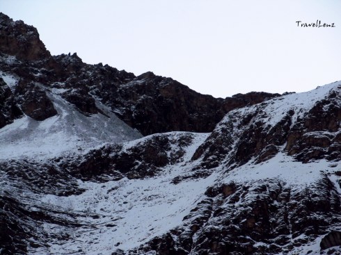
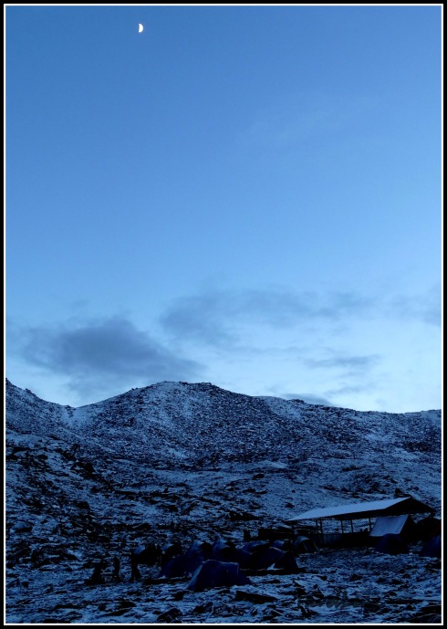
Up and at it before 4 am, the nightmarish reality of having to deal with the cold weather, dark surroundings, slippery ground and the anxiety of the unknown became all too real. We had to start the trek to Roopkund early in the morning while the snow was still hard. As the sun comes out, by mid morning, the snow melts and becomes soft and your feet start sinking in. Also, as it gets warmer, the hard ice gets slippery and it slows you down.
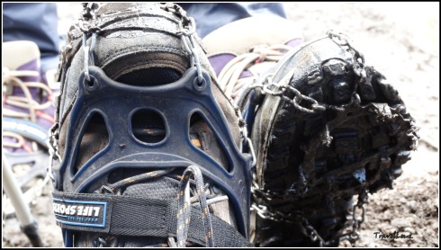
We got into our many layers of wool, gobbled down some breakfast, and strapped on our backpacks, head torches and crampons. We were not carrying much items today – just a few energy bars, an apple each and two bottles of water. By the time it was 5 am, there were already a number of groups ahead of us on the way to the mystery lake. From the camp till the Roopkund crater above, it’s a 3 km ascending hike through rock and snow.
It was scary in the beginning – it was dark and cold and we were not very sure of what lay on the path. We were advised to walk on the middle of the trail, and were told to try to step on the foot prints of the person in front which was difficult to find in the dark. The call “come on trekkers” from Raj Bhaiyya further boosted the confidence and determination to hit the target.
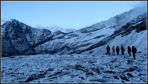
The first 1 km was a gradual ascent and not very difficult. As I turned back I could see a serpentine trail of head torches stretched across the line. As we trudged up, the altitude did hit us, and some of us were finding it a little difficult to take deep breaths. The wind picked up and we were thankful to have the extra layers as we staggered through the high mountain gusts. At a few places, the snow had become hard and was cut into steps. Every time I go on a trek, I find myself grateful to those who have gone before me and have smoothed a trail for me.
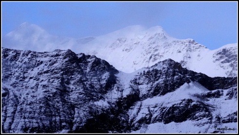
It was past 6 when the sun came out and hit the mighty Himalayan range. As for the view, it was magnificent. We could not see the rising sun but the rays glistened off the snow capped mountains and they appeared to be on fire. The Chaukhamba and several other mountains regaled in the most beautiful morning sky I had ever seen. The colours were different than anything I had seen before. And the feeble warmth acted like a cosy layer.
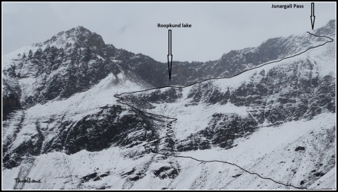
We had to climb through some tricky switch backs (the zig-zag line we had seen from the base camp), then a steep granite step surface, and a final steep climb over a snowy flank to reach Roopkund lake. There were times when unknown hands came to help. This is the kind of camaraderie we found throughout the trek. There were guides and support staff, even from other groups, who were always ready to lend a hand of help. On one stretch of vertical switchback I was literally dragged across by a guide from another group for 10 m – that actually translates to 100 m on plain ground.
The last stretch was exhausting and where we found our strength for that, I do not know. For the first time I learnt something very important; during mountain treks one faces danger, but dangers of a special kind – the dangers within oneself – vertigo, breathlessness, muscle fatigue and allowing ones nerves to get the better of one.
There were times when I wondered if this trek would ever end, but it did and the feeling of relief was fantastic. After the last scramble, the slope leveled out and we arrived on a ridge. And then the moment came when you find the geodetic marker, this time it read “Roopkund Lake 0 km” – that was the moment we were working toward for the past several hours. It was exactly 8 am.
All of us stood there panting in the crisp Himalayan air. I don’t know what the others felt, but amidst the high fives, handshakes and group hugs, I was having a bout of emotions – relief, happiness, excitement, a bit of hunger, and so much pride. I’d reached what feels like the top of the world both physically and mentally and it’s now mine to enjoy. Not just me – we were a group of 26 trekkers and all of us reached the lake. At 15700, this ain’t no Everest but it still is a summit of reckoning – and one we were all proud of having climbed.
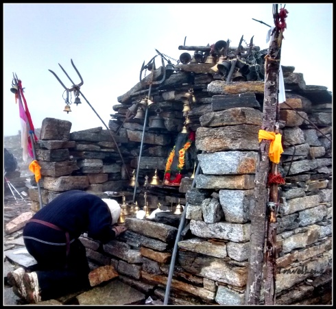
We spotted a skeletal remain on the ridge – a heap of bones placed on a rock. Raj bhaiyya said that both human and horse bones were found around the lake. On one side of the ridge was a small stone temple with figures of Nandadevi and Bholenath inside.
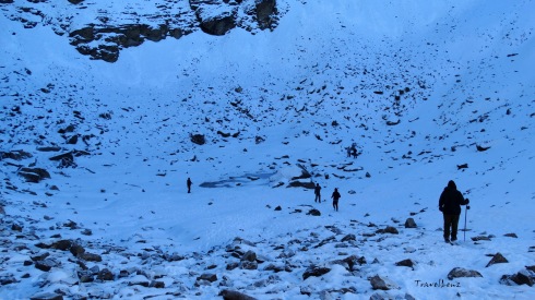
Ahead of us below in a snowy crater appeared a few clear splotches of water – the Roopkund Lake – or whatever remained of the lake that was now partially frozen and covered up in snow. In summers, the bones and skulls are exposed – as of now they remained buried in the snow.
To reach the bottom of the crater we had to climb down 50 ft. The steep crater walls had inches of snow covering the surface which deprived us of any sightings of more skeletons. We did find one skull arranged in the typical skull and cross-bone symbol near the lake. After a few customary photos and groupies we decided to perambulate the lake.
The 500 odd skeletons were discovered way back in 1942 by a park ranger. All the corpses had similar blows to the head and shoulders – short deep cracks on the skull and shoulder bones as if the blows had all come from directly above. It was found that the skeletons belonged to two kinds of groups. So was it a war that happened in the high altitude battle field?
As it turns out, all the bodies dated to around 850 AD. And DNA evidence indicated that there were two distinct groups of people leading experts to believe that the group comprised of pilgrims heading through the valley with the help of the locals. According to local legend, the King of Kanauj, along with his wife, servants, dance troupe and many others went on a pilgrimage to Nanda Devi shrine. While crossing Roopkund during a raging hail storm, the entire party of pilgrims were killed. The remains lay in the lake for 1,200 years until their discovery.
As we climbed up from the lake to the ridge, we found that the sun had fully risen and the glistening on the whiteness of peaks had reached all the way to the valley. Junargali was ruled out for us as we had reached late. We knew that getting to Roopkund is meaningless if you don’t climb up to Junargali. Two of our early arrivers climbed up to Junargali, accompanied by a guide. Junargali is a sharp ridge line that towers over Roopkund – a 250 ft steep climb from where we were standing. From Junargali , at 16,000 feet, you get clear views of Trishul and the adjoining mountain peaks.
We sat by the stone temple and had our breakfast.
The return journey was not very easy as we had thought; the snow had started to melt, making the trail slippery at a few places. One should be very careful when stepping on hard ice as it tends to get slippery. The snowy gradient looked dangerously sloping from this height, and the thought of climbing down those switchbacks was scary.
 At many places we had to negotiate the snow by squatting down on the ice. And while we were struggling to keep up with the slippery snow, we found Pushkar Bhaiyya sliding down the snow flanks on his back!!!. A few of our adventurous fellow trekkers tried the same; some managed to slide past without tumbling, a few took a few soft tumbles.
In broad daylight the vistas looked so different. Did we climb up along these trails just a few hours back?
But after a few vertical slopes, we reached back on level ground. We could spot our camp in a distance.
By 11.15 we walked into Bhagwabasa camp. Had a quick lunch, gathered our things and set out to Pathar Nachauni, our night camp, where we had stayed a night before. By 12.30 we had reached Kalu Vinayak and by 2 pm all the trekkers had reached home.
Most of the evening was spent at the dhabha in front of the camp, mulling over our accomplishment over endless cups of piping hot tea and plates of bread omelette.
That night, sleeping under the stars at Patharnachauni camp, I kept tossing and turning in my sleep bag. What an impressive physical, mental, and emotional accomplishment! Up there somewhere, Roopkund lake lay unmoved by our valiant effort of getting to her, a frozen little droplet surrounded by snow decked with the bones of a tragedy no one knew nothing much about. Click here for Day 6.
Day 5 in a nutshell
- Day 5: Bhagwabasa to Roopkund to Pathar Nachauni
- Distance: 11 km (Bhagwabasa to Roopkund and back: 6 km; Bhagwabasa to Pathar Nachauni: 5 km)
- Altitude: 14350 ft to 15700 ft
- Terrain: Steep ascent
- Difficulty: Difficult
- Time Taken: Around 3 hours from Bhagwabasa to Roopkund. Return took 2 hours. From Bhagwabasa to Pathar Nachauni it took 1.30 hours


