Category Archives: Uttarakhand

Roopkund Chronicles – Day 5: Summit Day

Day 5: October 2

What had become one of the longest days of my life would also become one of the most memorable days …. considering the way it all kicked off in the wee dark hours of a cold October morning. Today is the day we had been waiting for, preparing for, dreaming of, and believing in. Today is summit day.

Up and at it before 4 am, the nightmarish reality of having to deal with the cold weather, dark surroundings, slippery ground and the anxiety of the unknown became all too real. We had to start the trek to Roopkund early in the morning while the snow was still hard. As the sun comes out, by mid morning, the snow melts and becomes soft and your feet start sinking in. Also, as it gets warmer, the hard ice gets slippery and it slows you down.

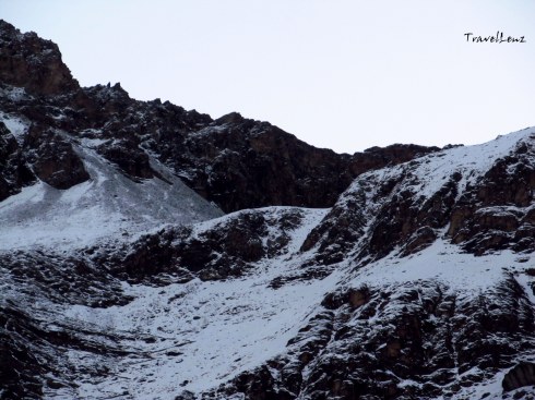
The snowy trails

We got into our many layers of wool, gobbled down some breakfast, and strapped on our backpacks, head torches and crampons. We were not carrying much items today – just a few energy bars, an apple each and two bottles of water. By the time it was 5 am, there were already a number of groups ahead of us on the way to the mystery lake. From the camp till the Roopkund crater above, it’s a 3 km ascending hike through rock and snow.

It was scary in the beginning – it was dark and cold and we were not very sure of what lay on the path. We were advised to walk on the middle of the trail, and were told to try to step on the foot prints of the person in front which was difficult to find in the dark. The call “come on trekkers” from Raj Bhaiyya further boosted the confidence and determination to hit the target.

The first 1 km was a gradual ascent and not very difficult. As I turned back I could see a serpentine trail of head torches stretched across the line. As we trudged up, the altitude did hit us, and some of us were finding it a little difficult to take deep breaths. The wind picked up and we were thankful to have the extra layers as we staggered through the high mountain gusts. At a few places, the snow had become hard and was cut into steps. Every time I go on a trek, I find myself grateful to those who have gone before me and have smoothed a trail for me.

The only range that matters is the Himalayan range

It was past 6 when the sun came out and hit the mighty Himalayan range. As for the view, it was magnificent. We could not see the rising sun but the rays glistened off the snow capped mountains and they appeared to be on fire. The Chaukhamba and several other mountains regaled in the most beautiful morning sky I had ever seen. The colours were different than anything I had seen before. And the feeble warmth acted like a cosy layer.

Spot the trekkers

We had to climb through some tricky switch backs (the zig-zag line we had seen from the base camp), then a steep granite step surface, and a final steep climb over a snowy flank to reach Roopkund lake. There were times when unknown hands came to help. This is the kind of camaraderie we found throughout the trek. There were guides and support staff, even from other groups, who were always ready to lend a hand of help. On one stretch of vertical switchback I was literally dragged across by a guide from another group for 10 m – that actually translates to 100 m on plain ground.

The switchbacks on the way

The last stretch was exhausting and where we found our strength for that, I do not know. For the first time I learnt something very important; during mountain treks one faces danger, but dangers of a special kind – the dangers within oneself – vertigo, breathlessness, muscle fatigue and allowing ones nerves to get the better of one.

There were times when I wondered if this trek would ever end, but it did and the feeling of relief was fantastic. After the last scramble, the slope leveled out and we arrived on a ridge. And then the moment came when you find the geodetic marker, this time it read “Roopkund Lake 0 km” – that was the moment we were working toward for the past several hours. It was exactly 8 am.

Roopkund – 0 km

All of us stood there panting in the crisp Himalayan air. I don’t know what the others felt, but amidst the high fives, handshakes and group hugs, I was having a bout of emotions – relief, happiness, excitement, a bit of hunger, and so much pride. I’d reached what feels like the top of the world both physically and mentally and it’s now mine to enjoy. Not just me – we were a group of 26 trekkers and all of us reached the lake. At 15700, this ain’t no Everest but it still is a summit of reckoning – and one we were all proud of having climbed.

We spotted a skeletal remain on the ridge – a heap of bones placed on a rock. Raj bhaiyya said that both human and horse bones were found around the lake. On one side of the ridge was a small stone temple with figures of Nandadevi and Bholenath inside.

Climbing down to Roopkund

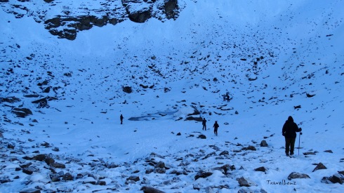
Ahead of us below in a snowy crater appeared a few clear splotches of water – the Roopkund Lake – or whatever remained of the lake that was now partially frozen and covered up in snow. In summers, the bones and skulls are exposed – as of now they remained buried in the snow.

Team at Roopkund

To reach the bottom of the crater we had to climb down 50 ft. The steep crater walls had inches of snow covering the surface which deprived us of any sightings of more skeletons. We did find one skull arranged in the typical skull and cross-bone symbol near the lake. After a few customary photos and groupies we decided to perambulate the lake.

The 500 odd skeletons were discovered way back in 1942 by a park ranger. All the corpses had similar blows to the head and shoulders – short deep cracks on the skull and shoulder bones as if the blows had all come from directly above. It was found that the skeletons belonged to two kinds of groups. So was it a war that happened in the high altitude battle field?

As it turns out, all the bodies dated to around 850 AD. And DNA evidence indicated that there were two distinct groups of people leading experts to believe that the group comprised of pilgrims heading through the valley with the help of the locals. According to local legend, the King of Kanauj, along with his wife, servants, dance troupe and many others went on a pilgrimage to Nanda Devi shrine. While crossing Roopkund during a raging hail storm, the entire party of pilgrims were killed. The remains lay in the lake for 1,200 years until their discovery.

View of Junargali from Roopkund lake

As we climbed up from the lake to the ridge, we found that the sun had fully risen and the glistening on the whiteness of peaks had reached all the way to the valley. Junargali was ruled out for us as we had reached late. We knew that getting to Roopkund is meaningless if you don’t climb up to Junargali. Two of our early arrivers climbed up to Junargali, accompanied by a guide. Junargali is a sharp ridge line that towers over Roopkund –  a 250 ft steep climb from where we were standing. From Junargali , at 16,000 feet, you get clear views of Trishul and the adjoining mountain peaks.

We sat by the stone temple and had our breakfast.

The return journey was not very easy as we had thought; the snow had started to melt, making the trail slippery at a few places. One should be very careful when stepping on hard ice as it tends to get slippery. The snowy gradient looked dangerously sloping from this height, and the thought of climbing down those switchbacks was scary.

At many places we had to negotiate the snow by squatting down on the ice. And while we were struggling to keep up with the slippery snow, we found Pushkar Bhaiyya sliding down the snow flanks on his back!!!. A few of our adventurous fellow trekkers tried the same; some managed to slide past without tumbling, a few took a few soft tumbles.

DSC03070

In broad daylight the vistas looked so different. Did we climb up along these trails just a few hours back?

Dangerous steps on the way

But after a few vertical slopes, we reached back on level ground. We could spot our camp in a distance.

Bhagwabasa camp

By 11.15 we walked into Bhagwabasa camp. Had a quick lunch, gathered our things and set out to Pathar Nachauni, our night camp, where we had stayed a night before. By 12.30 we had reached Kalu Vinayak and by 2 pm all the trekkers had reached home.

Most of the evening was spent at the dhabha in front of the camp, mulling over our accomplishment over endless cups of piping hot tea and plates of bread omelette.

That night, sleeping under the stars at Patharnachauni camp, I kept tossing and turning in my sleep bag. What an impressive physical, mental, and emotional accomplishment! Up there somewhere, Roopkund lake lay unmoved by our valiant effort of getting to her, a frozen little droplet surrounded by snow decked with the bones of a tragedy no one knew nothing much about. Click here for Day 6.

Day 5 in a nutshell

  • Day 5: Bhagwabasa to Roopkund to Pathar Nachauni
  • Distance:  11 km (Bhagwabasa to Roopkund and back: 6 km; Bhagwabasa to Pathar Nachauni: 5 km)
  • Altitude: 14350 ft to 15700 ft
  • Terrain: Steep ascent
  • Difficulty: Difficult
  • Time Taken: Around 3 hours from Bhagwabasa to Roopkund. Return took 2 hours. From Bhagwabasa to Pathar Nachauni it took 1.30 hours


Roopkund Chronicles – Day 3 – Ali Bugyal to Pathar Nachauni

Day 3: September 30

After a night of tossing and turning, we woke up at the crack of dawn.

Walk in the clouds

Walk in the clouds

Imagine waking up and rolling out of bed to be greeted by a misty mountain view, with the sun peeping out and pink skies above you. Well, in a tent you do not roll out, but crawl out. For the next few days we were to follow a few steps, or rather crawls and crouches, while getting in and out of a tent.

While getting out of a tent

  • Unzip your sleeping bag, which invariably gets stuck, the more you rush.
  • Sit in a crouching position.
  • Unzip the inner tent opening.
  • Crawl out till the inner tent opening, still struggling to free yourself from the clutches of your sleeping bag.
  • Now sit back down and stick your leg out so that you can put on your shoes.
  • Unzip the outer tent opening.
  • Lift yourself up still crouching and walk out of the tent.


While getting in

  • Open the outer zip.
  • Open the inner zip.
  • Have your back against the tent door and fall onto your rear (ouch!!!), your legs still jutting out of the tent.
  • Remove your shoes and crawl into the tent.

PS: And every time you remove/put on your shoes while you enter/exit the tent….arduous!

Armed with our tooth brushes we walked towards the fiberglass tents. Ali Bugyal camp did not have a running water source so we had to make do with the minimal water available which was stored in plastic containers. When you’re deep in the woods, miles away from the nearest restroom, it takes some extra effort to take care of your ‘business’ in a hygienic way. With generous dollops of hand sanitizer, tissue paper and wet wipes, keeping clean was often a struggle.  Without the modern conveniences we’ve become so accustomed to, keeping up with the bacteria, dirt, and grime was a constant challenge. At least, everyone smells equally bad on a high altitude trek. But it didn’t matter – we were all bundled up in many layers to smother the scent. And who actually cared – after all we were not there to take part in a beauty contest.

Misty morning at Ali Bugyal

In ten minutes we were holding onto our glasses of hot tea and taking in the vista in front of us. Green valleys spread out before us with a few clouds looming in the sky. A thick layer of fog hung throughout the valley, making it impossible to see what lay behind. Above the fog layer, the sky was a mixture of grey and pink.

Kalidak and Trishul [courtesy Ammu]

Kali Dak and Trishul from Ali Bugyal [courtesy Ammu]

The weather cleared slowly, the fog lifted and as the sun broke through the clouds, we could see the rim of the snow capped mountains, jutting out like vanilla cones sprinkled with dark chocolate – we were pointed out the Trishul peaks, Chaukhamba and Kali Dak.

Chaukhamba from Aki Bugyal [Courtesy Ammu]

Rolling mist and Chaukhamba from Ali Bugyal [Courtesy Ammu]

We spent some time on a vantage point taking snaps till the breakfast call came.

@ 12000 ft

Heights of posing @ 12000 ft, Ali Bugyal

By 8.30 our luggage was loaded onto the mules and the first set of trekkers were already on their way. We walked up from the camp, passed a stone temple and were now hiking on the huge Z mark we had seen the previous day. The hike was not tough as we were passing on plain trails.

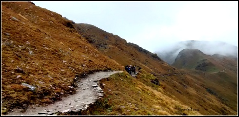
Our next camp was Pathar Nachauni, 5 km away. The trail to Pathar Nachauni was along a mountain edge, a narrow path with mountains on one side and a sloping valley on the other side.

Traversing bugyal land

Traversing bugyal land

In half an hour we were walking by another Himalayan meadow – Bedni Bugyal. Bedni Bugyal lay down in the valley on our left. In the middle of the grass land there was a pond – Bedini Kund. Locals believe that Maharishi Ved Vyas compiled all the four Vedas in this valley. There were two small stone temples near the Bedini Kund. We could also see a camping site, complete with a dozen tents and a couple of fiberglass tents.

Bedni Kund [Courtesy Ani & Sabari]

Bedni Kund [Courtesy Ani & Sabari]

We would be cutting through the Bedni Kund on our way back. There are two approaches to the meadows of Bedni Bugyal from the plains, one from Loharjung via Didna, Tolpani and Ali Bugyal – which we had taken – and the other, a steep climb directly from Wan village. We ascended through the first and would descend the other way.

Near the Kund, we could see a line of trekkers from another group. They were struggling as they climbed from the valley along a steep zig zag path to reach the main mountain trail we were moving on. We did thank our stars that we did not have to go through that steep climb in the morning. On our way back we would be taking that path down.

Trekkers climbing up from Bedni Valley

Trekkers climbing up from Bedni Valley

The trek today would take us through Ghora Lautani before we reach our camp at Pathar Nachauni. Ghora Lotani stands at a height of 3945 m and is about 2.5 kms from Ali Bugyal. It gets such a name because horses would never go up from this place – the place from where the horses returned home.

@ Ghora Lautani

@ Ghora Lautani

By 11 we reached Ghora Lautani. As there was a chance of rain, we were instructed to get into our rain wear immediately. The clouds had started to build over the mountains and there was an occasional peal of lightning accompanied by a flat rolling roar. Till now the nature Gods were pleased with us and we had not faced any showers, hail or snow.

Never ending trail to Pathar Nachauni

After Ghora Lautani, we had now moved onto the other side of the mountain. There were signs of major landslides that looked really scary.

Landslides at Ghora Lautani

Landslides at Ghora Lautani

The valleys looked browner than green, a sign that we were gaining altitude. The valley was covered with clouds which shielded the white peaks of Trishul and Nanda Ghunti.

Brown valleys at Ghora Lautani

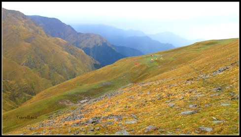
From Ghora Lautani to Pathar Nachauni (1.5 kms), the trek was easy, almost going downwards. After 30 minutes or so we could spot a campsite on the right side, which belonged to another trek company, amidst an extensive alpine meadow down in the valley. The camp looked colourful with a dozen yellow and orange tents. Our campsite was further up on a ridge on the left side of our trail. By 11.50 we trickled into Pathar Nachauni. We were now standing on ground that was 12766 ft (3900 m) above sea level.

Reaching Pathar Nachauni camp

The camp consisted of two rows of 16 tents, 8 on one side bang opposite to each other. There was a huge mess tent, a few fibre glass tents and a shed for the mules. The toilet tents were placed further away up on the ridge. There was a small dhaba right in front of the camp.

Pathar Nachauni Camp

Pathar Nachauni Camp

We had barely reached the camp and it started to rain.

Slushy camp @ Pathar Nachauni after the rains and hail storm

The food provided throughout the trek by TTH was of top quality. Our menu was never repeated, and we were served with a variety of dishes. After a sumptuous lunch we thought we’d explore the place with Raj Bhaiyya. The rain had stopped now, but the whizzing Himalayan icy winds were on the prowl. Pathar Nachauni is a brown meadow, sprinkled with rocks – small and large.

Rocks and meadows @ Pathar Nachauni

Raj bhaiyya told us story, a popular folklore associated with the name of this place. A local King, on a pilgrimage to Nanda Devi, stayed at this place. He was traveling with a large group which also included a few dancers. The King got so lost in their performance that he finally forgot about the pilgrimage. Nanda Devi cursed the King and turned all dancing girls into rocks – thus the name Pathar Nachauni. An interesting story indeed.

The trail from Pathar Nachauni to Kalu Vinayak

The path from our camp led up to a steep hill and we were to follow this winding path tomorrow. The small temple of Kalu Vinayak lay somewhere amidst the mountains ahead of us. The trail between Pathar Nachauni and Kalu Vinayak is considered as the most difficult stretch to cover, because of the steep climb and altitude gain.

Team @ Pathar Nachauni...and don't miss the pink gloves [courtesy Ani & Sabari]

Team @ Pathar Nachauni…and don’t miss the pink gloves [courtesy Ani & Sabari]

 Tomorrow we would be camping higher – at the highest camp of this trek – Bhagwabasa. And tomorrow we would also get the first glimpse of our destination – Roopkund lake – or at least the mountain where Roopkund lay hidden in a shallow crater. Tomorrow is always better than today.

Day 3 in a nutshell

  • Day 3: Ali Bugyal to Pathar Nachauni via Ghora Lautani
  • Distance: Around 5 kms
  • Altitude: 11520 ft to 12700 ft [3510 m to 3900 m]
  • Terrain: Gradual ascent from Ali Bugyal to Ghora Lautani and downhill trek from Ghora Lautani till Pathar Nachauni.
  • Difficulty: Easy
  • Time taken: Around 3.5 hours


Roopkund Chronicles Day – 1 Loharjung to Didna


Nanda Ghunti glistens [Courtesy Ani & Sabari]

Day 1: September 28

Now, if you were to ask me just which were the most memorable moments of the whole Roopkund trek, I wouldn’t have to think too hard. Crawling out of the rajai on the first morning and staggering out on to the balcony in the morning chill to see the sun climb over the Nanda Ghunti peak is, chronologically, the first.

The second, obviously, has to be just after the last step up to the Roopkund lake and the first glimpse of the expanse of snow flecked by a tiny speck of water in the middle…dotted further by the clumsily trodding trekkers around it and, certainly not the least arresting, the sight of the bones propped up inelegantly here and there.

Finally, it would have to be the sight of the unsightly jeep that stood waiting for us as we completed the Roopkund trek and sauntered onto Wan village’s sparsely populated main market – signaling the end of the mission.

The team [Courtesy Ani & Sabari]

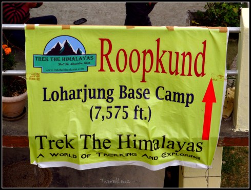
Repacked and breakfasted, everyone trooped out animatedly, on to the common area. The TTH poster on the balcony confirmed we were at a height of 7575 ft (2300 m). We stood in groups chatting, our backpacks sent away for loading on the ponies. Yes, we were part of the sub-group that opted to walk with only our day packs. There were moments in the trek when we, unconsciously, let it rankle us but I can assure you the occasions were few and far between as we negotiated steep ascents, thin air and tired limbs.

Soon, there was a staff member who thrust some chocolates, biscuits and bananas into each hand – fuel for the walk ahead. Finally, the time came when the trek leader, Raj Shahi, a handsome, affable and supremely fit Nepali mountaineer, sounded the whistle and, in a jiffy, had everyone’s attention.

After a show of raised arms and cries in solidarity and resolve, the group took to the path that marked the start of the Roopkund trek. It was 8.45 am. With our day packs on our back and the trekking poles pecking holes on the path, we were now on our way.

Starting point [Courtesy Ani & Sabari]

 Our lungs were full and our limbs strong and we walked in twos and threes and some in larger sets and some still solo. Some were chattering away, some cracking the one off remark and some still in total silence.

From the village we started by descending down a mountain track. There were loose rocks and small streams flowing across the trail. We got our first lessons on how to climb down a slippery trail. Stay completely focused on where you place your feet. Instead of pointing your feet straight downwards, point your feet sideways and edge down slowly. Lengthen your poles, if you are carrying hiking poles.

[Courtesy Ani & Sabari]

The down hill path [Courtesy Ani & Sabari]

We descended in a file, first with just a few steps separating each of us. In time, that was to yawn further and as we walked the trek, there were some way in front, most others filling the middle and a few that brought up the rear.

Countryside [Courtesy Ani & Sabari]

Trekking through the countryside [Courtesy Ani & Sabari]

Our three guides, including the trek leader Raj Shahi, spread themselves too – Pushkar, a cheery 40 something, stockily built Uttaranchali, was in charge of the front, Raj Bhaiyya with the larger lot in the middle and Amar, a young, lean local shepherding the tail.

The high of a trek had just begun and was working like a shot of energy drink and we did not quite require many a pit stop. We passed a stone bridge on the way, took a few snaps.

Stone bridge on the way [Courtesy Ani & Sabari]

Stone bridge on the way [Courtesy Ani & Sabari]

It was a sunny day, and the heat was already taking a toll when we did stop for our first break at 10 am. Off came a few layers. We had taken this break at a clearing as much to rest as to take a few burst of snaps. Around us were the tall mountains that were only going to get taller as we pressed on in the next few days.

[Courtsey Ani & Sabari]

Our first official pit stop [Courtesy Ani & Sabari]

An hour’s walk and we heard the gush of water. It was the Bedni Ganga. We hop scotched across a few rocks on the river bed to get to the other side.

Crossing Bedni Ganga [Courtesy Ani & Sabari]

Crossing Bedni Ganga [Courtesy Ani & Sabari]

Later we paused at the Raun Bagad bridge for a few snaps. We could also see a high water fall nearby.

Raun Bagad Bridge

Raun Bagad Bridge

From there on, things became more business-like and metamorphosed from a hike mode onto a trek. After crossing the bridge,  it’s a steep never ending uphill climb to Didna. This is physically one of the most challenging stretches in this route. The grueling trek up continued for another 1.5 kms.

Panting and puffing

Panting and puffing

At the end we had walked into the surroundings of our first night’s halt – Didna village. As we walked up the concrete pavement that led to the village, we found out that there were not too many people and houses around, but we spotted a shop selling basic stuff and a camp of another trek company.

Walking into Didna

Walking into Didna

Further up, a few hundred metres away, we trudged up to see a welcome sign, of our camp. It was 12.45 pm, exactly 4 hours after we had left our base camp. And we were @ 8530 ft/2600 m above sea level

Team at Didna [Courtesy Ani & Sabari]

Team at Didna [Courtesy Ani & Sabari]

The early arrivals were already catching their breath and the views around, chatting up and taking snaps.

Our camp @ Didna

Our camp @ Didna [Courtesy Ani & Sabari]

 Our camp was a typical Utharanchali stone building with two short storeys that had dormitory style accommodation waiting to be occupied.

And here comes our luggage

And here comes our luggage

We caught a bed each and rushed out to the lunch laid out on the table outside. Soon, the others too had trooped in and the whole team of 27 had reached ‘home’.

Beautiful Didna village

We spent the evening sauntering about, taking in the views of the hills around, walking around the village which had a dozen thatched houses and vast expanses of ‘Ramdana’ (a local crop) fields. The red sprawling Ramdana fields looked quite pretty from a distance. We also chatted up with Raj Bhaiyya about his exploits in the Himalayas, and, of course, the rest of the Roopkund trek.

In and around Didna

In and around Didna; Ramdana fields

Dinner was a happy affair – as much for its being a wholesome treat as also because we were happily hungry. Crawling into our cosy quilts, we could hear voices high and low, cracking jokes, talking of the experiences of the day and about what awaited us on the morrow. The best part about finishing the first day of any trek is the warm glow of having taken the initial step but also the delectable angst of what lay ahead. Go to Day 2

Day 1 in a nutshell

  • Day 1: Loharjang to Didna village
  • Distance: Around 6.5 kms
  • Altitude: Not much gain. 7575 ft to 8530 ft [2300 m to 2600 m]
  • Terrain: Downhill trek from Loharjung till Bedni Ganga for the first three hours. Steep uphill trek from Bedni Ganga to Didna for the last one hour.
  • Difficulty: Easy to moderate
  • Time taken: Around 4 hours


Roopkund Chronicles – Day 0 Kathgodam to Loharjung

Most high altitude treks start with trepidation more than preparation, budgeting, finding the right operator and, no less, getting the right group of co-trekkers. Ours too was no different. The question we asked ourselves was not long and was a hard hitting two words? Could we?

But such is the lure of a trek like Roopkund that the answer is usually a conclusive Yes. And then the flurry of activity begins. We tossed a well-researched coin in and decided to go with Trek the Himalayas, a Delhi based adventure and outdoor company.

For three full months, the treadmill, the stairs, the open road and a lean diet was what we thought we should be doing. Which, of course, we did not always! But come midnight of 26th September, 2014, as we waited in the dirty, dingy platform of Old Delhi railway station for the Ranikhet Express, we were a much fitter pack than we were when we drooled over the snaps of Roopkund we saw on the internet months back.

Day 0: September 27

I have always loved the first step I take at Kathgodam station. It was less about love for the place, per se, as it was about the excitement of hitting the gateway to the magnificent Kumaon Himalayas. The drive further, wherever it led to, was always the stuff that sublime holidays stand for. And this one, we knew, would be another one of those!

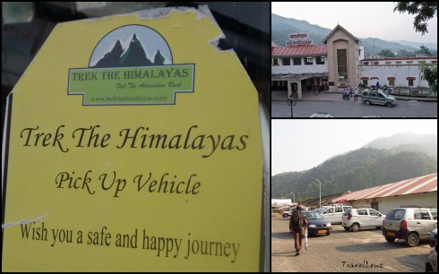
Finding our Sumos was easy – they came tagged.

The 222 km drive up to Loharjung, our base camp, was gradually ensconcing the traveller into a world of mountains and high altitude. As our vehicles sped past the still waters of Bhimtal and the sleeping town of Bhowali, the day was still filtering through the thick blanketed early morning mist.

A heavy breakfast, bouts of vomiting and doses of Avomine later, our road worn Sumos passed the small hilly towns of Someshwar, Kausani, Baijnath, Gwaldham, and Dewal before swinging into the little base town of Loharjung.

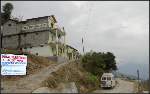
At this stage, we felt light and our backpacks lighter. As we stood on the terrace of the Patwal Tourist Lodge & Holiday Home, TTH’s Loharjung Base Camp, there were stars in our eyes and a few in the dark but clear skies above us. Before us, the snow clad peaks of Nanda Ghunti glistened like a large and friendly apparition, beckoning us. We had dumped our bags inside the small rooms and an extra layer of woolens were as comforting as the dinner spread the TTH team had laid out for us.

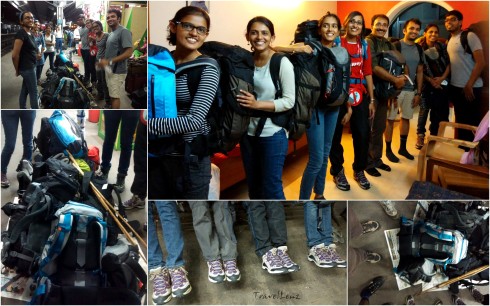
But first, the rites of passage. The larger group of 26 had all regrouped on the verandah and stood chattering and rubbing our hands, more from the chill than just glee. And then the TTH team manager welcomed us and got each of us to introduce ourselves, talk a little about the previous treks we had done, if any, and then laid out the ground rules for the trek. Dinner over, we wriggled into our rajais and made peace with our new environment and the next week’s plans were as much a part of that night’s dreams as were the glimpses of the day’s journey till the base camp.

Tomorrow, the trek begins. Up there, where the earth and the sky meet lies Roopkund – amidst snow and scattered pieces of skeletons. Who knows what happened yesterday but today – tonight – we knew we would sleep tight…and tomorrow would be the beginning of an adventure…a great one! Go to Day 1


Roopkund Chronicles – Prologue

Amidst the blinding white lay a clump of bones, propped up more inelegantly than it ever had been inside of a human frame, ages ago. Just how it came to pass that it still lay there in fresh snow in front of a troop of panting but relieved trekkers who braved the cold, the distance, the altitude and the reputation of a mysterious lake to stand and stare at it, is the stuff that great adventure trips are made of.

And that is what Roopkund is all about. Months of preparation and expectation, the bone chilling weather, the difficult mountain, the 4800 m (16000 ft) summit, the 53 km trek over 6 days, the wonderful company (of course!) and something that no other trek can promise – the unsolved mystery of untold deaths and the hundreds of human skeletons that adorn the rims and bottom of a hidden lake in the high Himalayas.

Over the next few posts I’ll be sharing our Roopkund Chronicles. Stay tuned for our moments of exultation, our lapses of consciousness, blissful mindfulness, fights with breathlessness, and being one with the precious stillness. The trek to the mystery lake begins here…..

For day wise stories click on the links below

Day 0: Kathgodam to Loharjung

Day 1: Loharjung to Didna

Day 2: Didna to Ali Bugyal

Day 3: Ali Bugyal to Pathar Nachauni

Day 4: Pathar Nachauni to Bhagwabasa

Day 5: Bhagwabasa to Roopkund to Pathar Nachauni

Day 6: Pathar Nachauni to Loharjung


Panchachuli – Close, Closer, Closest

I will never forget the first time I saw the Himalayan range. It was my first visit to Nainital and we were staying at the Swiss Hotel, which sits a fair way beyond the high court on the upper Mallital side. We knew there was a Snow view point that could be reached by a cable car, but we wanted to avoid the crowd. Then somebody at the hotel told us about a more secluded, off beat view point. We got the directions and started off by following a path right behind the hotel which took us to a flight of stone steps. We climbed the steps which led to a road. We started walking or rather climbing the road. When we passed some tourists coming down the road, we knew that we were on the right path. There were villagers carrying wood and calling out to each other rushing pass by us, small kids on their way to school taking short cuts. It was a bright sunny day, but the road was  shady due to the thick canopy. We must have walked for about 20 minutes when we came to a sharp turn. And there in front of us lay the Himalayan range, gleaming in the sun. The mountains gave a clear white picture against the clean blue sky. There were a handful of tourists, mostly foreigners enjoying the view from a watch tower and basking in the sun. A couple of small shops selling tea, water and biscuits were also around.

The Himalayan range as seen from Nainital

The Himalayan range as seen from Nainital

We had with us a postcard carrying all the names and altitudes of the mountains, visible from Nainital, for our reference. From the left there was Nanda ghunti, Trishul, Mrigthuni, Maiktoli, Nandadevi and its peaks, Pindari glacier, Nanda Kot, Panchachuli and then the peaks of Mt Api in West Nepal. But what stood out, for more than one reason, was the Panchachuli range. The name, the myth, and the simple reason, for the way it looked.

The Panchachuli peaks are a group of five snow-capped Himalayan peaks lying at the end of the eastern Kumaon region. The peaks have altitudes ranging from 6334 m (20,781 ft) to 6904 m (22,651 ft). The name is derived from the legendary Pandavas’ “Five Chulis” (cooking hearths), where they cooked their last meal before proceeding toward their heavenly abode.

When I saw the Panchachuli peaks lying there at the end of the graph, five peaks, one after the other, I had this sudden urge of seeing the peaks a little closer.

In the following years we made several trips to the hills. Binsar, Mukteshwar, Kausani being some of the destinations. The mountains never changed nor did the sheer excitement of seeing them. But that clear picture of the five peaks eluded me.

Once while visiting a photo exhibition, I came across a photo of the Panchachuli peaks taken from Chaukori. There were these pretty green cottages arranged in a neat row in a beautiful garden with the mighty Panchachuli peaks in the background. If the photo itself was breathtaking then I could imagine how the real place would be.  While admiring that photograph I was already making  plans to visit Chaukori. Chaukori, at a height of 6,595 ft, is a beautiful tourist spot with great views of the snow-capped Himalayan range.  The entire area has a lot of  tea gardens and fruit orchards that are simply great for treks.

Catching the sun on the way to Almora

Catching the sun on the way to Almora

So on a cool November evening we boarded the Ranikhet express from the old Delhi station to Kathgodam.  We reached Kathgodam by 6.30.  Before 7 we had already caught a shared taxi to Almora. The sun was already peeping through the pine trees and we slowly started climbing our way to Almora. We passed Bhimtal and Bhowali, and then stopped near Kainchi ashram around 8 to have breakfast.

Kainichi ashram

Kainchi ashram

By 9.30 we reached Almora.  Mist was hanging prettily over this hilly town. We had to walk  through a maze of small bylanes and markets to reach the taxi stand. From there we took a shared jeep to Berinag.  The jeep was over crowded and cramped. And the driver was still looking out for prospective passengers. At each bump the entire jeep groaned and shrieked. And to add to the agony the agarbatti fumes were making me sick. Though the journey was uncomfortable,  the scenery was beautiful and at its best. The mountains were playing hide and seek all the way.

On the way to Chaukori

On the way to Chaukori

The jeep stopped for lunch, that we conveniently skipped, at Dhaulchini.   By 2.30 we reached Berinag. Chaukori was just a half an hour drive from there. We reached the KMVN guest house by 3.30.

KMVN's cottages

KMVN’s cottages

And there right out of my picture postcard stood my favourite peaks. The trees from the picture had grown and were obstructing the peaks a bit.  A watch tower was conveniently placed on the grounds of the KMVN guest house. We climbed the watch tower and took in the scenery.

and the peaks

and the peaks

The sun was already going down and  the Panchachuli peaks looked pretty in the evening light. Tired and hungry from the jeep journey, we had dinner and slept early. We decided to get up early and explore the premises.

Panchachuli - before sunrise

Panchachuli – before sunrise

We got up before sunrise. Chaukori was slowly waking up to a lazy early winter morning.  We took a small path behind the guest house and walked through a tea garden till we reached an open space that dropped down to a terraced valley. From here the Panchachuli peaks definitely looked more spectacular than I had imagined.

Sunrise

Sunrise

The sun had started to peep over the Himalayan range on the Nepal side on the eastern side. Our camera was doing over time and clicking away.  The sunlight had started  to fall on the mountains and they  looked refreshingly new with every passing minute.  The mountains were definitely closer, but I wanted more. We decided to go to Munisiyari for the  closest view.

View from the watch tower

View from the watch tower

The journey from Chaukori to Munisiyari took almost 5 hours. We changed vehicles three times.  From Chaukori we took an overcrowded bus to Udiyari bend. From Udiyari bend we took a jeep to Thal. Here most of the journey was downhill. From Thal we crossed a bridge over Ramganga East, walked by a stone Kali temple  and came to a bazaar and from there we caught another jeep to Munisiyari. We were starting to climb the hilly road now.

Following the Kali river

Following the Ramganga river

The drive took us past some of the most beautiful valleys and the Ramganga river was accompanying  us all the way. Every bend brought a fresh view, often better than the last one. It was amazing how the slightest change in elevation altered the perspective completely.

Munisiyari, situated on the banks of Goriganga river, is a favourite destination for  high altitude trekkers and nature lovers  and is commonly used  as a base camp.  By 1 we reached Munisiyari.

KMVN Munisiyari

KMVN Munisiyari

The guest house was a  building with green roofs right out of the Raj era. And to add to the beauty of the guest house was the magnificent sight of the Panchachuli peaks.

Panchachuli from our room

Panchachuli from our room

We checked in, and our room had excellent views of the 5 peaks.  After lunch we decided to see the local Nanda Devi temple which promised us better views of the peaks. It was a 45 minute walk from the guest house. Our walk first took us through the crowded market lanes. After getting directions from a shopkeeper we continued looking for a petrol pump. From the pump we walked straight into a meadow.

On the way to Naina Devi temple

On the way to Nanda Devi temple

Right ahead we could see a wooded area beyond which were the the steps to the temple.  Perched on the edge of a small hill was the Nanda Devi temple with the peaks in the background.

On the steps of Naina Devi temple

On the steps of Nanda Devi temple

There were deep valleys with houses ahead. We could see the Goriganga river at a long distance in the valley.

Naina Devi temple with the peaks

Nanda Devi temple with the peaks

There was no one around, other than some grazing cattle and langurs in the woods behind. But there was this eerie feeling of being constantly watched. Maybe the peaks were watching us.

Watching and being watched

Watching and being watched

We sat there for about an hour, gazing at the peaks, taking photos, inhaling  the sweet mountain breeze and enjoying the silence.  While walking back to the village we passed a lot of women with all their wares on their backs going back home after a busy day at the market. We walked up from the village to the school ground which also serves as a helipad.   By then the sun had begun to set and the peaks were changing colours from gold, to orange, to red and finally pink.

From the helipad

Peaks seen from the helipad

The ground was bustling with all kinds of people. There were other tourists who were enjoying the sun set and a lot of kids who were playing cricket on the grounds.

Enjoying cricket

Enjoying cricket

We had planned a day trek for the next day.  So we had our dinner early and slept.

Golden peak

Golden peak

The next day after having an early breakfast, we started from the guest house around 7 am. We had packed lunch and snacks with us. Bhuvan, an employee at the KMVN guest house, had agreed to accompany us on this trek. Being a localite he knew well about the area and had done the trek many times before. From Munisiyari we took a jeep to Balati bend. From there Khuliya top was 8 km.

Setting off on the trek

Setting off on the trek

We started the trek around 7.30.  We took a stone path from the road that led us through some pretty woods. Steps were made into the path wherever necessary. The climb was fairly easy but we were panting in no time. But the cool mountain air could only energise our spirits. We rested in between, took photos and enjoyed the scene.

View of the village and the peaks during the trek. The helipad is seen on the extreme right.

View of the village and the peaks during the trek. The helipad is seen on the lower extreme right.

From certain points the whole village was visible. We could even spot the helipad and the Nanda Devi temple we had visited the previous day.  It has snowed 2 days back, so we had to walk over snow at some places on the way. The snow had started to melt and it was soft and slushy.

Walking along the snow

Walking along the snow

The woods had a  luxuriant mix of Pine, Deodar, Oaks, Spruce and Cypress, but the main vegetation we came across as we gained height were the Raapta trees.  In spring the whole jungle turns red with the rhododendron flowers. We were not lucky enough to see them in full bloom.  We spotted some monal pheasants and langurs on the way.

The guest house under construction

The guest house under construction

Around half way on the route is a guest house. When we took the trip in November 2008, the guest house was under construction and to be completed before new year.  We sat on the steps for a while, had tea and snacks and continued our walk. As we climbed up further the vegetation suddenly changed. The woods gave way to  grass lands. The air was getting cooler and we knew we were approaching the summit.

Finally at the top

Finally at the top

and somebody was here before us

and somebody was here before us

Suddenly we came to a pastureland. The snowcapped mountains were fringing the skyline on one side and on the other side were these endless undulating hills.

Snowy mountains on one side

Snowy mountains on one side

Hills on the other side

Hills on the other side

It took us 4 hours to reach the top. We sat there for an hour and had our lunch.  The descent was more easier.

The climb down

The climb down 

We took shortcuts and reached the road by 2.30.  We waited for a jeep for an hour and then decided to walk down to Munisiyari.  Instead of following the road we took shortcuts and passed through villages and fields and finally reached the guest house at 5.

The sun was about to set and this was our last day with the peaks. Was this the closest I could ever get to the Panchachuli peaks?  I knew there were treks to the Panchachuli base camp and even further up for the adventurous. I don’t think I’m ready or equipped to climb a mountain. But a trek to the base camp sounds interesting.  There is always a next time….