Tag Archives: Kibithu

On the Eastern Most Road of India – to Kaho and Kibithu

Half a century ago, India suffered its worst military attack, and subsequent defeat, throwing open a gaping hole at the border, and proving how unprepared India was, militarily and politically. On the 50th anniversary of the Chinese invasion, this post is dedicated to some of our bravest soldiers who fought, who died, and who went missing during Indo-China War, 1962. 

*********************************************************************

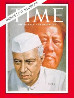
In November 1962, TIME magazine paid a tribute to the Indian soldiers who fought in the Indo-China War in Walong.  It said, ‘At Walong, Indian troops lacked everything. The only thing they did not lack was guts’.

Time Magazine November 30 1962  (ed)[http://www.time.com/time/covers/0,16641,19621130,00.html]

In October 1962, when  the Chinese planned their incursion into the north-eastern sector inIndia, a region they would later call the “Tiger’s mouth”, they exposed the unready state of the Indian military. At the same time, what stood out was the heroic resistance of the Indian soldiers. The tragic bloodshed took place around the hills in Namti , near Walong, which has a special place in the history of India’s battles.

Rise and Shine – Walong Valley

From 22 October 1962 till the fall of Walong, on the 16th of November 1962, soldiers from the Sikh, Kumaoni, Gorkha and Dogra regiments fought a common enemy, shoulder-to-shoulder, in this unknown territorry. Ill-equipped and totally under prepared for such battles, some of the soldiers had to withdraw, crawling through the treacherous terrain. The rest of the soldiers never received any orders. Totally cut from their battalion, the soldiers fought it out to the last bullet, to the last man, till there was nothing left.

When the firing was over, and cease-fire declared, the army returned to the inhospitable terrain only to find that the Chinese had marked the positions of the dead. The Indian bunkers showed the dead where they had last manned their weapons. The Chinese had at least paid respect to their dead enemies – all the bodies were covered.

It is not uncommon to find the remains of the war, even now. Burnt pieces of army uniforms, fire arms, live ammunition, and other personal items lie scattered under rocks, tall grass and pine trees on the mountains.

People pay tribute to Sepoy Karam Chand Katoch (Inset) in Palampur [Photo Courtesy PTI]

In July  2010, the Border Road Task Force found a circular identity disc, PIS No. 3950976, and a silver ring, while clearing landslides in Walong. When the army checked the war records, they found that the disc belonged to Sepoy Karam Chand Katoch of the 4th Dogra Regiment. The local army unit  then dug the area and found the remains of Karam Chand, along with a fountain pen, dilapidated pay book and a few ammunition. His mortal remains were flown to his home in Palampur, in Himachal Pradesh, from where, as a 19 year old soldier, he had left home  to fight for his mother land. Before they flew his mortal remains, he was given a full honor salute at the War Memorial in Walong.

How tragic that the selfless acts of bravery goes unknown to the majority of Indians?

Around the Walong circuit house

The next morning, up early, we drove further east. The first stop, just outside Walong town and past the Army complex, was the memorial built by the Lohit Brigade to salute the brave and selfless sacrifices made by the Army men during the 1962 war. Known as the ‘Hut of Remembrance’, here the names of each of the martyrs who had laid down their lives in defence of the Lohit valley in 1962 is etched in marble.

Hut of Remembrance at Walong

We spent a few minutes walking around the black marble plaques, reading the names of the young soldiers who fought on the rugged mountain tops, suffering from extremes of cold, hunger and thirst, only to lay down their lives for our better tomorrow.  It was a sombre moment for both of us.

The war memorial and epitaph that I mentioned in the previous post stands on the Namti Plains, by the Lohit River, to commemorate the exemplary sacrifice of our brave soldiers.

At the hot springs in Tilam

But before visiting the war memorial we had to take a detour to Tilam.   Just 4 km out of town, Tilam is known for its hot springs that, reportedly, have medicinal properties. On the banks of the springs a brand new circuit house was getting readied. We parked in front of the circuit house and walked down to the springs. Though a bit dirty, the water was boiling hot.

The hanging bridge on the way to Dong

We walked a bit further over a hanging bridge to where the climb up to Dong village begins. Overlooking Burma and China, this village has cornered the distinction of being the Indian habitation to catch the first rays of the sun. It’s a climb of an hour and a half hour which needs to be commenced at 3 in the morning, and not without a guide or a local.

It was in the turn of the last millennium when flocks of tourists swarmed to the hill top here to catch the first rays of the first sunrise of the 21st century light up the Dong valley and, in time, the rest of the country. We wanted to walk to ‘Millennium Point’ at Dong but we had to take permission from the Indian Army and without a permit no one could go.

Namti Plains

Promising that we would take the walk to Dong the next time, we climbed back into our vehicle. Our next destination was Kaho. On the climb up to Kaho, there was little traffic. The Namti plains stretched before our eyes, pretty and pine laden. After a brief stop at the war memorial we proceeded further.

War Memorial at Namti Plains

With every turn, the mountains on the Chinese side grew larger in view. The settings were so surreal. I was trying to imagine the place about 50 years back. A yellow board reminded us of being on the eastern most road in India.

On the eastern-most road in India

We crossed a few metal bridges and were now driving along the Lohit River. Jayantoda mentioned that all these bridges had been replaced recently from the traditional ones. A ‘traditional’ one still hung precariously a bit further. We were standing in front of what the Mishmis call a ‘bridge’. In reality, it was just a lot of planks tied together that straddled both the banks of the Lohit. At that great height, the uncontrollable swing of the bridge and the turquoise water raging down below, a walk up to the other end and back needs some steely nerves. And I had to do it.

On the hanging bridge near Kaho

Mission accomplished, we drove into Kaho, a small village on the eastern most border, situated in a small valley surrounded by towering mountain peaks, most of them on the Chinese side. Kaho has around nine households. Cutting into the serenity of this small village is the constant presence of the Army all around and after all, the Line of Actual Control is not too far from here. Besides the village school, a monastery and a small tea shop cum PCO, Kaho is all about silence and the virgin beauty that the landscape offers.

Kaho village

We walked in to the Lohit Goodwill school and said hello to the children there. The teacher, apologetic about the poor attendance – the school had just reopened after Dushera –  showed us into her class rooms. There were only four children, five were absent. The teacher herself had reached the previous night from Tezu, her home town, after the holidays.

Lohit Goodwill School

From the school we walked up to the monastery only to realize that it was closed. A short climb up from the monastery is an Indian Army outpost and we paid them a courtesy visit. The two jawans at the look out were gracious enough to point out where the border lies and the various peaks on both sides and allowed us a quick peek through their binoculars at Chinese side.

“I can see a house with blue paint”, I said triumphantly. “Well, the Chinese can see the print on your dress, Madame”, one of the jawan said teasingly. “They have a binoculars powerful than ours and they are constantly monitoring the civilian traffic in our area. If they see more traffic, they get stressed out and if they get stressed out, it indirectly affects our sleep”. For civilians like us this journey is just a picture in an album, a page in a book. For the army its the whole volume.

The blue houses on the other side

On the way back, we drove up to Kibithu, currently the brigade HQ of the Indian Army.

Kibithu

Here civilian entry is monitored if not entirely restricted. We had to give our details at the check post. The helipad here used to be an attraction for the great views it offered. Presently, it is out of bounds for anyone who is not army and photography is not permitted.

Kibithu – Army camp

We stopped for lunch in one of the small restaurants there. I never knew that the humble 2-minute Maggie could be so delicious.

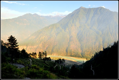
The first glimpse of Lohit River entering into India [the furthermost mountains are in China]

There was one more place to visit before we drove back to our guest house. Equally touching and another must-see point in Walong is the Helmet Top, 18 kms by road above Walong. A patriotic pilgrimage of sorts that every Indian needs to take, Helmet Top was once a vantage point for the Indian army. During the war, a few of the Indian soldiers were stranded here. None of their counterparts back at the headquarters were aware of this. Exposed to the cold, suffering from hunger, thirst and frost bite, the soldiers were left to die. It is said that, after the battle was over, all that remained of the gallant Indian defenders were their helmets. Today, a memorial stands in a grim reminder of their courage and commitment.

Helmet Top [http://commons.wikimedia.org/wiki/File:Helmet_Top_Walong_Memorial_Arunachal_Pradesh.jpg]

We started our climb up to Helmet top. The air got cooler, and the houses and the river got smaller and smaller. The road was concrete for around 10 km or so, after which it was all gravel and sand. Jayantoda had to get down at a few places to remove a stone which must have rolled down or a fallen tree branch.

Half way up the Helmet top mountain

We must have covered around 15 km, and the white war memorial building was visible through the pine trees up above. But luck seemed to evade us. A big rock now lay in front of us blocking the whole road. We didn’t even try to move it, it was that huge. Jayantoda said if it had been a kilometer or so we could have tried walking to the top. But this was a risk. We were trying to find the positive side in it. What if the rock had fallen after we had passed that way? We would have had to spend the night at Helmet Top. Dejected, we decided to turn back.

On the way down we stopped at a small water fall and plucked a few wild oranges that could not have been more sour.

We decided to walk around the town before sun down. We met the same kids we had seen yesterday and they insisted on not only taking a few more photographs of them but also seeing the pictures we had taken yesterday. In return I was presented with a few wild flowers.

Our little friends and their gift

The sun was going down and this was our last night in Walong. When I closed my eyes, trying to sleep, along with the mountains and valleys that came rolling by, a small poem composed by a Walong veteran kept ringing in my ears.

The sentinel hills that round us stand
bear witness that we loved our land.
Amidst shattered rocks and flaming pine
we fought and died on Namti Plain.
O Lohit gently by us glide
pale stars above us softly shine
as we sleep here in sun and rain.

We had to come back another time, for we had promised ourselves a sunrise at Dong and a prayer at Helmet Top.

The Road to Walong – Following the Lohit River

In 2011, in the month of October, we spent 21 days in the north-eastern states of Assam, Arunachal Pradesh and Meghalaya. I am publishing a few posts this October to mark the anniversary of our travels on those lesser trodden paths. It is a year since we traveled to the north-east, but there is not a single day that we are not reminded of the beauty and the magic of the place. 

**********************************************************************

On a cold night in the month of November, way back in 1962, when the whole of India was slumbering under a cosy woollen blanket enjoying the early winter temperature, a few weary soldiers were battling with whatever remained of their last energy trying to fend off the enemy from the north-eastern most corner of their mother land. The ‘Battle for Walong’ was about the worst of fighting conditions – cold weather, treacherous terrain, outnumbered troops, ‘orders’ that never reached and a slimy enemy – all weighing heavily on the Indian soldiers. For 22 days, they gallantly fought with limited resources, but with unlimited ferocity and aggression.  Eventually, the Chinese crossed the Lohit River and completed the ‘Fall of Walong’ on the 16thNovember, 1962.

We were standing in front of a newly built memorial  that the Lohit Brigade had constructed on the Namti plains, overlooking the Lohit River, where most of the crossfire had taken place 50 years ago. The black granite stone tells, in a poignantly written tribute, the story of the “bloody nose” that the Indian Army gave the enemy and the pledge that “Walong will never fall again”.

The previous day we had started early from Tezu, the district headquarters of the Lohit district. Leaving behind the shaded avenues and the spacious government quarters, we took the road out of Tezu to Demwe.  It was only past 7.00 am, but was warm enough for us to throw away our sweaters. We passed the road that wound up to the Tafragam village and passed hordes of school girls on cycles making their way up to Vivekananda Kendra Vidyalaya in Tafragam.

Girls on the way to VKV Tafragam school

Just before the Demwe bridge we passed a map of Arunachal Pradesh that had been elaborately painted on to a wall by the Border Roads also known as GREF in these areas. Before our journey to Arunachal we had scoured the net and book stalls for maps, but never did we come across such a neat map. The map showed the distances from Demwe to most of the major villages and towns across Arunachal Pradesh.  According to the map, we had 190 km more to cover to reach our destination – Walong.

Arunachal Map [The black line shows our route from Tezu to Walong]

Further up the road, another sign reminded us that the ‘hill sector’ had started.  We reached a Y-junction. Here the NH 37 coming up from Chowkham via Parasuramkund joins in on the journey.  We climbed up the road, moved ahead of the the Hawa pass and reached the Hawa army camp. Just above the army camp was a view point.

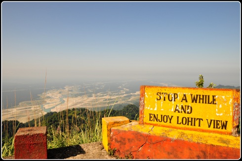
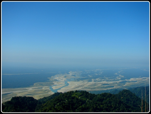
We got down from our Scorpio to spend some time at the viewpoint. The views from here were amazing. The panoramic view of the magnificent Lohit valley spread across our eyes. Aptly named the Lohit view point, Jayantoda said that this place was best known for the sunset and sunrise. The Lohit River lay there glistening in the early sunlight.

The Lohit View Point

There was very little water in the river and the white sand banks stood out in contrast with the numerous shallow water channels. Further left we could also catch a glimpse of the Parasuramkund and the newly built bridge across the river. That bridge led to Wakro, our home away from home.

Parashuramkund Bridge

Lohit is the farthest eastern most tributary of Brahmaputra. The Lohit River originates from the Tirap Phasi ranges in Eastern Tibet and  enters India through Kibithu, a small village lying at the border. After entering India, the river traverses though the Mishmi hills of the Anjaw and Lohit district and joins the Brahmaputra after travelling for about 200 km through the red laterite soils of the Lohit basin, thus giving it the name – the ‘river of blood’. On our journey to Walong, we would be tracing the Lohit River back to Kibithu where it enters into the territory of India.

The long stretch of lonely road ahead

From here on,  the route snakes up and there is not much for company other than the high-ceilinged mountains and the feisty Lohit river playing a constant consort all the way up to Walong and beyond. And there are a good 200 km of near empty road ahead all the way to our destination. Occasionally, we came across the odd jeep – this is not classic car territory – or a bike. Tourists are a rarity in these parts and most of the Sumos and Scorpios are busy ferrying locals from the many far flung villages higher up to Tezu and Tinsukia and back. We were ourselves in good hands with both our Scorpio and its driver, Jayantoda, as seasoned as the other. The one other traffic of note was the small convoys of Army trucks that were, customarily, given the right of way.

Giving way to the army trucks

Whenever an army truck came against us Jayantoda would ask the driver at the head of the convoy, with a gesture of his hand, the number of trucks in the convoy. And the army driver would, in turn, gesture with his hand the number of trucks in the convoy.

We crossed the ‘Udayak Pass’ and then came to a small shrine that was built by the road side. A place where accidents occurred frequently, the locals had built this shrine so that the travellers could pay respect to all the Gods and Goddesses before commencing on their journey to the eastern most part of the north east.

A road side shrine

We prayed and paid our respects, to all those Gods and all those nameless fellow travellers who had lost their lives, for our safe journey. By 9 am we rolled into a small village, Salangam.

Breakfast at Salangam

Jayantoda had planned our breakfast here. And moreover the next big village was Hayuliang, 2 hours and 46 km away. After a simple breakfast of ‘roti-dal-onion-chilly’ we were on the road again.

There was something very odd about the vegetation in these areas. Every tree, plant, shrub and undergrowth looked as if they were on steroids. The ferns looked liked palm trees and the humble bamboo thickets were giant in size. Were the cattle on steroids as well? Right in front of us stood a fat cow-buffalo hybrid species. Our Scorpio came to a sudden halt and Jayantoda with all his enthusiasm pointed out and said ‘Mithun’.

Mithun

I was not expecting Mithunda, of all people, to groove to the tunes of ‘Disco Dancer’ in a remote village in Anjaw district. Well, our Mithun was munching away on a green patch on the road side, totally unaware of its new found attention.

The Mithun are reared for meat and are highly preferred among the tribal people of North-East. Mithun is also used as a ceremonial animal in sacred traditional functions and as a gift to the bride in weddings thus playing an important role in the social and cultural life of the tribal people of North-East.

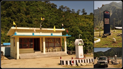
Leaving our Mithun behind, we drove further. Other than Hawai, the district headquarters of Anjaw district, Hayuliang is the biggest town en route to Walong. We stopped at the small fuel station at Khupa near Hayuliang to tank up our vehicle for the remaining 100 km drive up to Walong.

Fuel station at Khupa

All along, Lohit was playing a loyal companion. Gushing loudly at times showing its true blue colours, turning a more paler turquoise on a few occasions, changing to a more greener hue and gelling well with the verdant surroundings, and on a very few occurrences turning to a more slaty black in the many whirlpools.

Lohit River

On the way we came across a lot of construction workers sweating themselves, toiling in the sun, trying to pave a better road for travellers like us.

For a better road, for a better tomorrow

We made a pit stop near the bridge to Hawai.  The district headquarters of the newly created Anjaw District, Hawai is situated on a hill across the Lohit River. Promising ourselves that we would visit Hawai on our way back from Walong, we took a few snaps and continued on our journey to Walong.

Hawai Bridge

Walong was about 50 km from Hawai. All throughout, the route was interspersed by sturdy metal bridges. A lot of these modern bridges are built by the Indian army and Border roads organisation. Other than these nondescript bridges, the many hanging bridges across the charging Lohit river are bound to catch one’s attention. We stopped at a couple and tested our guts and our resolve. Some of the hanging bridges we crossed were made of bamboo and wooden planks, apart from the metal cables that run along the side and connect it to the ends.

Leaving behind my acrophobic partner with Jayantoda, I tried crossing a fairly long hanging bridge. The floor of the bridge was creaking under my clumsy step and the entire bridge swinging in tandem. Below, through the gaps of missing wood planks, the mighty turquoise Lohit river was gushing and rushing loudly, leaving me breathless. And then a couple of school children came running along the bridge looking queerly at me and perhaps amused at my discomfort.

Well, practice does make one perfect. But what about fear of heights? Must be non-existent in these places. We drove into Walong by 3 pm but it looked as if it was just before sundown. In the muted evening sun, however, there was enough of the town to catch a glimpse of.

Our first glimpse of Walong

The first thing you would notice here is the silence. Other than the odd shout from a bunch of kids playing nearby, all we could hear was the unrestrained gurgle of the Lohit in its mad rush from the Chinese mountains up above. The small town of Walong is all about the settlement on either side for a few hundred metres. There are shops in a row on one side of the road and houses complete the line up on the other. The smattering of small structures apart, the only major signs of habitation is the large army base here.

The main (and only) road at Walong town

The road splits and one led us up towards the side of the hills and to the Circuit House above. We were lucky to get a booking here for there is virtually no accommodation option otherwise. For the lone stay option, the Circuit House is delightfully good. The location, for one, couldn’t be better. From the vantage point above the Walong town, the rooms looked out on to the mountain peaks all around and the valley below.

View of Walong town from the circuit house

In the distance, by its banks, the army settlement was a constant reminder of how sensitive a place it still was, despite all its serenity and beauty. As with all circuit houses, the warmth of the staff and the homely taste of the food is what sticks with you. But unlike many, it was uncharacteristically clean with spacious well appointed rooms with an uninterrupted power supply!

In front of the circuit house

We had not had our lunch, so we went in search of food, as the kitchen was not yet open at the guest house. After buying the staple food of bread, jam and butter, we walked along the sparsely populated main road of Walong – a few shops were still open, a PCO, a provisional store, a tea stall and a barber shop. Men and women were seen huddled together around chatting, kids played in groups and the sun kept going down.

A few of the little friends we made

On the bank of the river, the army quarters spread out, the helipad standing out in contrast with the decorum of the camp. We climbed back to the circuit house through a short cut from the market, climbing up a steep flight of stone steps. As the last rays of the sun lit up the mountains and the river, the first electrical lights of Walong came on.

All night long, the chirping of the crickets and the gush of the Lohit completed the background score. We had a busy day tomorrow. For we had to pay our respects at the War Memorial, visit the hot springs at Tilam and travel on the eastern most road in India and visit the villages of Kaho and Kibithu located further ahead near the border. Before we knew, sleep and fatigue caught up and we dozed off.